Area Overview for LE5 5LZ
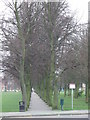
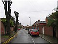
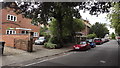
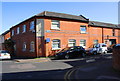
Photos of LE5 5LZ


Area Information
LE5 5LZ is a compact residential postcode in England, covering just 3,599 square metres and home to 2,002 residents. Its high population density of 556,204 people per square kilometre reflects a tightly knit community, where proximity to amenities and services is a defining feature. The area is characterised by a mix of housing stock, predominantly owner-occupied homes, and a demographic skewed towards adults aged 30–64. Living here means navigating a small, densely populated space where daily life revolves around local shops, schools, and transport links. The postcode’s proximity to Leicester and its surrounding railway stations ensures easy access to urban hubs, while the presence of primary schools adds to its appeal for families. However, the area’s small size means every resident is likely familiar with their neighbours, creating a sense of community that contrasts with the challenges of limited space and high density. For those prioritising convenience and connectivity, LE5 5LZ offers a blend of practicality and proximity to essential services.
- Area Type
- Postcode
- Area Size
- 3599 m²
- Population
- 2002
- Population Density
- 5322 people/km²
The property market in LE5 5LZ is dominated by owner-occupied homes, with 62% of residents owning their properties. This contrasts with areas where rental demand drives the market, indicating a focus on long-term residency rather than short-term investment. The accommodation type is primarily houses, not flats or apartments, which aligns with the area’s mature demographic and family-oriented profile. Given the postcode’s small size, the housing stock is limited, making it a niche market for buyers seeking specific properties. The high population density suggests that properties are closely packed, potentially limiting availability for new buyers. However, the strong home ownership rate implies stable property values and a low turnover of homes. For those considering the area, the compact nature of LE5 5LZ means buyers must prioritise proximity to amenities and transport links, as expansion is unlikely. The market is likely competitive, with limited options for those seeking larger or newer properties.
House Prices in LE5 5LZ
Showing 1 properties
| Address | Type | Beds | Baths | Last Sale Price | Last Sale Date | |
|---|---|---|---|---|---|---|
| Cressall Ltd Formerly Standard Cressall Ltd, Evington Valley Road, Leicester, LE5 5LZ | Industrial | - | - | - | - |
Energy Efficiency in LE5 5LZ
Residents of LE5 5LZ have access to a range of amenities within practical reach. Retail options include Co-op Evington, Tesco Leicester, and Sainsburys Leicester, providing everyday shopping convenience. The area’s rail network connects to Leicester Railway Station, South Wigston, and Syston, facilitating easy travel to urban and suburban destinations. Leicester Airport is also nearby, offering additional transport flexibility. For leisure, the presence of multiple rail and metro stations suggests opportunities for commuting to cultural or recreational hubs. While the data does not specify parks or leisure facilities, the proximity to Leicester implies access to larger urban amenities. The compact nature of the area means amenities are closely clustered, reducing travel time for daily errands. However, the lack of detailed information on parks or green spaces means buyers should investigate further for outdoor recreation options. The combination of retail, transport, and urban connectivity makes LE5 5LZ practical for a variety of lifestyles.
Amenities
Schools
LE5 5LZ is served by four primary schools, including Mayflower Primary School and Coleman Primary School, both rated as satisfactory by Ofsted. Additionally, Madani Girls’ School and Madani Boys School are rated as good, offering higher standards of education. The presence of two schools with good Ofsted ratings provides families with options for quality primary education, while the satisfactory-rated schools may suit those prioritising affordability or proximity. The mix of school types reflects a diverse educational landscape, though the data does not indicate secondary schools or further education facilities. For families, the availability of multiple primary schools within the area reduces the need for long commutes, supporting a child-centred lifestyle. However, the absence of secondary school data means buyers should investigate additional educational options beyond the primary level. The overall school infrastructure suggests the area is well-suited for families with young children.
| Rank | School | Type | Entry gender | Ages |
|---|
Explore more schools in this area
Go to Schools tabDemographics
The population of LE5 5LZ skews heavily towards adults aged 30–64, with a median age of 47. This suggests a community of established professionals and families, rather than a younger or elderly demographic. Home ownership is strong, with 62% of residents owning their homes, compared to 38% renting. The area is predominantly composed of houses, not flats, indicating a focus on traditional family homes. The predominant ethnic group is Asian_total, reflecting a culturally rich and diverse community. However, the data does not specify further breakdowns, such as sub-ethnic categories or other minority groups. The high population density, combined with a mature age profile, implies a stable, long-term resident base. For buyers, this demographic suggests a market driven by owner-occupiers seeking established, family-friendly properties. The absence of detailed deprivation data means it is unclear how economic factors might influence quality of life, but the high home ownership rate suggests a relatively affluent community.
Household Size
Accommodation Type
Tenure
Ethnic Group
Religion
Household Composition
Age
Household Deprivation
NS-SEC
Explore more demographic insights in this area
Go to Demographics tabPlanning
Planning Constraints
- Flood RiskPremium
- Ramsar Wetland SitesPremium
- Area of Outstanding Natural BeautyPremium
- Protected Nature ReservePremium
- Protected WoodlandPremium