Area Overview for LE5 3LD
Photos of LE5 3LD
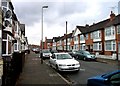
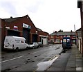

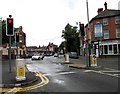

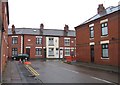
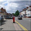
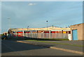
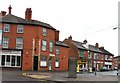
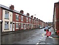
45 photos from this area
Area Information
Key information about the LE5 3LD including its size, population, and administrative classification.
- Area Type
- Postcode
- Area Size
- 1.1 hectares
- Population
- 2857
- Population Density
- 21321 people/km²
House Prices in LE5 3LD
16
Properties
£105,714
Average Sold Price
£30,000
Lowest Price
£185,000
Highest Price
Showing 16 properties
| Address | Type | Beds | Baths | Last Sale Price | Last Sale Date | |
|---|---|---|---|---|---|---|
| 72 Bridge Road, Leicester, LE5 3LD | Terraced | 3 | 1 | £130,000 | Oct 2021 | |
| 80 Bridge Road, Leicester, LE5 3LD | Terraced | 2 | 1 | £185,000 | Apr 2021 | |
| 82 Bridge Road, Leicester, LE5 3LD | Terraced | 3 | 1 | £150,000 | Oct 2018 | |
| 129 Bridge Road, Leicester, LE5 3LD | house | - | - | £95,000 | Sep 2012 | |
| 74 Bridge Road, Leicester, LE5 3LD | house | - | - | £110,000 | Dec 2005 | |
| 78 Bridge Road, Leicester, LE5 3LD | house | - | - | £30,000 | Aug 1998 | |
| 84 Bridge Road, Leicester, LE5 3LD | Terraced | - | - | £40,000 | Oct 1997 | |
| 68 Bridge Road, Leicester, LE5 3LD | house | - | - | - | - | |
| 70 Bridge Road, Leicester, LE5 3LD | Terraced | - | - | - | - | |
| 106 Bridge Road, Leicester, LE5 3LD | Flat | - | - | - | - |
Page 1 of 2
Energy Efficiency in LE5 3LD
Amenities
Schools
| Rank | School | Type | Entry gender | Ages |
|---|
Explore more schools in this area
Go to Schools tabDemographics
Household Size
Family (3-5 people)
most common
Accommodation Type
Houses
most common
Tenure
42
majority
Ethnic Group
asian_total
most common
Religion
N/A
most common
Household Composition
N/A
most common
Age
47
median
Adults (30-64 years)
most common
Household Deprivation
N/A
with no deprivation
NS-SEC
7
in Lower managerial occupations
Explore more demographic insights in this area
Go to Demographics tabPlanning
Planning Constraints
- Flood RiskPremium
- Ramsar Wetland SitesPremium
- Area of Outstanding Natural BeautyPremium
- Protected Nature ReservePremium
- Protected WoodlandPremium