Area Overview for LE5 3DT
Photos of LE5 3DT
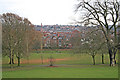
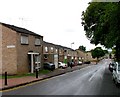
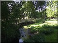
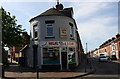
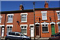
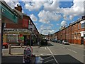
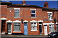
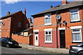
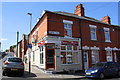
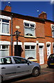
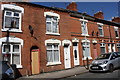
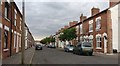
96 photos from this area
Area Information
Key information about the LE5 3DT including its size, population, and administrative classification.
- Area Type
- Postcode
- Area Size
- 2463 m²
- Population
- 1940
- Population Density
- 15192 people/km²
House Prices in LE5 3DT
21
Properties
£111,639
Average Sold Price
£28,000
Lowest Price
£245,000
Highest Price
Showing 21 properties
| Address | Type | Beds | Baths | Last Sale Price | Last Sale Date | |
|---|---|---|---|---|---|---|
| 55 Sherrard Road, Leicester, LE5 3DT | Retail | 2 | 2 | £245,000 | Oct 2022 | |
| 51 Sherrard Road, Leicester, LE5 3DT | Terraced | 3 | 1 | £205,000 | Aug 2020 | |
| 65 Sherrard Road, Leicester, LE5 3DT | Terraced | 3 | 2 | £160,000 | Mar 2018 | |
| 81 Sherrard Road, Leicester, LE5 3DT | Terraced | 3 | - | £125,000 | May 2015 | |
| 57 Sherrard Road, Leicester, LE5 3DT | house | - | - | £89,250 | Jan 2010 | |
| 83 Sherrard Road, Leicester, LE5 3DT | Terraced | 3 | 2 | £73,500 | Jun 2007 | |
| 75 Sherrard Road, Leicester, LE5 3DT | house | - | - | £45,000 | Aug 2001 | |
| 49 Sherrard Road, Leicester, LE5 3DT | house | - | - | £28,000 | Oct 1998 | |
| 73 Sherrard Road, Leicester, LE5 3DT | house | - | - | £34,000 | Dec 1995 | |
| 77 Sherrard Road, Leicester, LE5 3DT | Terraced | - | - | - | - |
Page 1 of 3
Energy Efficiency in LE5 3DT
Amenities
Schools
| Rank | School | Type | Entry gender | Ages |
|---|
Explore more schools in this area
Go to Schools tabDemographics
Household Size
Family (3-5 people)
most common
Accommodation Type
Houses
most common
Tenure
44
majority
Ethnic Group
asian_total
most common
Religion
N/A
most common
Household Composition
N/A
most common
Age
47
median
Adults (30-64 years)
most common
Household Deprivation
N/A
with no deprivation
NS-SEC
9
in Lower managerial occupations
Explore more demographic insights in this area
Go to Demographics tabPlanning
Planning Constraints
- Flood RiskPremium
- Ramsar Wetland SitesPremium
- Area of Outstanding Natural BeautyPremium
- Protected Nature ReservePremium
- Protected WoodlandPremium