Area Overview for LE5 3DN
Photos of LE5 3DN
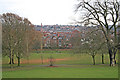
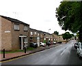
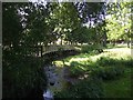
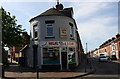
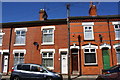
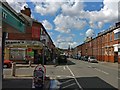
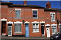
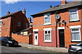
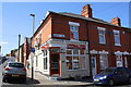
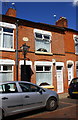
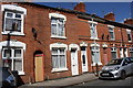
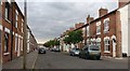
96 photos from this area
Area Information
Key information about the LE5 3DN including its size, population, and administrative classification.
- Area Type
- Postcode
- Area Size
- 5238 m²
- Population
- 2206
- Population Density
- 37839 people/km²
House Prices in LE5 3DN
49
Properties
£98,461
Average Sold Price
£18,525
Lowest Price
£200,000
Highest Price
Showing 49 properties
| Address | Type | Beds | Baths | Last Sale Price | Last Sale Date | |
|---|---|---|---|---|---|---|
| 37 Mount Road, Leicester, LE5 3DN | Retail | 2 | 1 | £200,000 | Jun 2022 | |
| 55 Mount Road, Leicester, LE5 3DN | house | - | - | £180,000 | Mar 2021 | |
| 59 Mount Road, Leicester, LE5 3DN | Terraced | 2 | 1 | £190,000 | Apr 2020 | |
| 49 Mount Road, Leicester, LE5 3DN | house | 2 | 1 | £190,000 | Feb 2020 | |
| 73 Mount Road, Leicester, LE5 3DN | house | - | - | £103,950 | May 2019 | |
| 77 Mount Road, Leicester, LE5 3DN | house | - | - | £133,000 | Jan 2017 | |
| 11 Mount Road, Leicester, LE5 3DN | house | - | - | £134,000 | Apr 2016 | |
| 7 Mount Road, Leicester, LE5 3DN | Terraced | 3 | 1 | £125,000 | Feb 2015 | |
| 61 Mount Road, Leicester, LE5 3DN | house | - | - | £81,000 | Mar 2014 | |
| 27 Mount Road, Leicester, LE5 3DN | house | 2 | 1 | £88,000 | Feb 2013 |
Page 1 of 5
Energy Efficiency in LE5 3DN
Amenities
Schools
| Rank | School | Type | Entry gender | Ages |
|---|
Explore more schools in this area
Go to Schools tabDemographics
Household Size
Family (3-5 people)
most common
Accommodation Type
Houses
most common
Tenure
60
majority
Ethnic Group
asian_total
most common
Religion
N/A
most common
Household Composition
N/A
most common
Age
47
median
Adults (30-64 years)
most common
Household Deprivation
N/A
with no deprivation
NS-SEC
9
in Lower managerial occupations
Explore more demographic insights in this area
Go to Demographics tabPlanning
Planning Constraints
- Flood RiskPremium
- Ramsar Wetland SitesPremium
- Area of Outstanding Natural BeautyPremium
- Protected Nature ReservePremium
- Protected WoodlandPremium