Area Overview for LE4 1AT
Photos of LE4 1AT
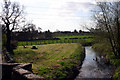
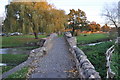
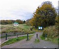
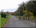
55 photos from this area
Area Information
Key information about the LE4 1AT including its size, population, and administrative classification.
- Area Type
- Postcode
- Area Size
- 9.1 hectares
- Population
- 2703
- Population Density
- 1501 people/km²
House Prices in LE4 1AT
41
Properties
£127,197
Average Sold Price
£27,000
Lowest Price
£242,000
Highest Price
Showing 41 properties
| Address | Type | Beds | Baths | Last Sale Price | Last Sale Date | |
|---|---|---|---|---|---|---|
| 70 Stoneywell Road, Leicester, LE4 1AT | Semi-detached | 2 | 1 | £237,500 | Nov 2025 | |
| 31 Stoneywell Road, Leicester, LE4 1AT | Semi-detached | 2 | 1 | £226,000 | Aug 2025 | |
| 64 Stoneywell Road, Leicester, LE4 1AT | Bungalow | 2 | 1 | £242,000 | Aug 2023 | |
| 84 Stoneywell Road, Leicester, LE4 1AT | house | - | - | £241,000 | Sep 2022 | |
| 53 Stoneywell Road, Leicester, LE4 1AT | house | - | - | £210,000 | Aug 2021 | |
| 50 Stoneywell Road, Leicester, LE4 1AT | Semi-detached | 2 | - | £200,000 | Jun 2021 | |
| 45 Stoneywell Road, Leicester, LE4 1AT | Terraced | 3 | - | £135,000 | Jul 2017 | |
| 78 Stoneywell Road, Leicester, LE4 1AT | house | - | - | £200,000 | Apr 2016 | |
| 29 Stoneywell Road, Leicester, LE4 1AT | house | - | - | £137,000 | Dec 2015 | |
| 46 Stoneywell Road, Leicester, LE4 1AT | Detached | 3 | - | £160,000 | Jul 2015 |
Page 1 of 5
Energy Efficiency in LE4 1AT
Amenities
Schools
| Rank | School | Type | Entry gender | Ages |
|---|
Explore more schools in this area
Go to Schools tabDemographics
Household Size
Family (3-5 people)
most common
Accommodation Type
Houses
most common
Tenure
52
majority
Ethnic Group
White
most common
Religion
N/A
most common
Household Composition
N/A
most common
Age
47
median
Adults (30-64 years)
most common
Household Deprivation
N/A
with no deprivation
NS-SEC
32
in Lower managerial occupations
Explore more demographic insights in this area
Go to Demographics tabPlanning
Planning Constraints
- Flood RiskPremium
- Ramsar Wetland SitesPremium
- Area of Outstanding Natural BeautyPremium
- Protected Nature ReservePremium
- Protected WoodlandPremium