Area Overview for LE4 1AG
Photos of LE4 1AG
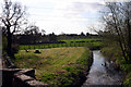
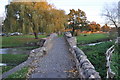
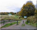
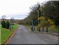
55 photos from this area
Area Information
Key information about the LE4 1AG including its size, population, and administrative classification.
- Area Type
- Postcode
- Area Size
- 1.9 hectares
- Population
- 2703
- Population Density
- 1501 people/km²
House Prices in LE4 1AG
42
Properties
£115,124
Average Sold Price
£10,500
Lowest Price
£277,000
Highest Price
Showing 42 properties
| Address | Type | Beds | Baths | Last Sale Price | Last Sale Date | |
|---|---|---|---|---|---|---|
| 35 Pitchens Close, Leicester, LE4 1AG | Terraced | 3 | 2 | £136,000 | Feb 2023 | |
| 38 Pitchens Close, Leicester, LE4 1AG | Semi-detached | 3 | - | £277,000 | Jan 2023 | |
| 39 Pitchens Close, Leicester, LE4 1AG | house | - | - | £183,500 | Oct 2021 | |
| 18 Pitchens Close, Leicester, LE4 1AG | house | - | - | £145,000 | Apr 2021 | |
| 41 Pitchens Close, Leicester, LE4 1AG | Terraced | 3 | 1 | £162,000 | Apr 2020 | |
| 20 Pitchens Close, Leicester, LE4 1AG | house | - | - | £152,500 | Dec 2019 | |
| 27 Pitchens Close, Leicester, LE4 1AG | Detached | 4 | 1 | £175,000 | Jul 2019 | |
| 3 Pitchens Close, Leicester, LE4 1AG | Terraced | 3 | 1 | £133,000 | Dec 2017 | |
| 13 Pitchens Close, Leicester, LE4 1AG | Semi-detached | 4 | 1 | £134,950 | Jun 2016 | |
| 6 Pitchens Close, Leicester, LE4 1AG | Semi-detached | 3 | 1 | £87,000 | Oct 2013 |
Page 1 of 5
Energy Efficiency in LE4 1AG
Amenities
Schools
| Rank | School | Type | Entry gender | Ages |
|---|
Explore more schools in this area
Go to Schools tabDemographics
Household Size
Family (3-5 people)
most common
Accommodation Type
Houses
most common
Tenure
52
majority
Ethnic Group
White
most common
Religion
N/A
most common
Household Composition
N/A
most common
Age
47
median
Adults (30-64 years)
most common
Household Deprivation
N/A
with no deprivation
NS-SEC
32
in Lower managerial occupations
Explore more demographic insights in this area
Go to Demographics tabPlanning
Planning Constraints
- Flood RiskPremium
- Ramsar Wetland SitesPremium
- Area of Outstanding Natural BeautyPremium
- Protected Nature ReservePremium
- Protected WoodlandPremium