Area Overview for LE3 8HD
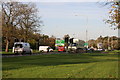
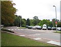
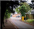
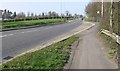
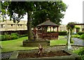
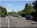
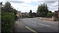
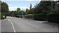
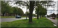
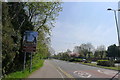
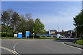
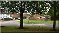
Photos of LE3 8HD
Area Information
Living in LE3 8HD means inhabiting a tightly packed residential cluster in England, where 1841 residents occupy just 19.5 hectares. This equates to a population density of 9441 people per square kilometre, reflecting a compact, densely populated area. The median age of 47 suggests a community skewed towards middle-aged adults, with 89% owning their homes. Houses dominate the accommodation type, indicating a stable, family-oriented environment. The area’s small footprint means amenities and services are likely within walking distance, though its size also implies a close-knit, perhaps insular character. With no major environmental constraints or planning restrictions, LE3 8HD offers a straightforward living experience. Its proximity to rail and metro networks, including Leicester Railway Station and Rothley, ensures connectivity to nearby towns. For those prioritising safety, the area has a low crime risk and no flood or ecological hazards. However, the high density and limited space may mean a need for community cooperation in managing shared resources. This is a place for those seeking a settled, low-maintenance lifestyle with strong local ties.
- Area Type
- Postcode
- Area Size
- 19.5 hectares
- Population
- 1841
- Population Density
- 2208 people/km²
The property market in LE3 8HD is characterised by a high rate of home ownership—89% of residents own their homes—suggesting a strong preference for long-term investment over rental living. The accommodation type is predominantly houses, which is unusual in densely populated areas and may indicate a mix of older properties or family homes. Given the area’s small size, the housing stock is likely limited, with little scope for new development. This makes the market relatively stable but potentially less dynamic for buyers seeking a variety of property types. The high home ownership rate also implies a community where property values are likely to be resilient, as residents are less inclined to move frequently. For buyers, this means a focus on existing homes rather than new builds, with the need to consider the practicalities of living in a compact, high-density area. The absence of planning constraints or environmental restrictions may also make it easier to purchase without additional legal hurdles.
House Prices in LE3 8HD
No properties found in this postcode.
Energy Efficiency in LE3 8HD
Daily life in LE3 8HD is shaped by its proximity to retail and transport hubs. The area’s retail landscape includes notable venues such as Co-op Aikman, Tesco Dominion, and Morrisons Glenfield, providing a range of shopping options within practical reach. These stores cater to everyday needs, reducing the necessity for long commutes. The transport network is similarly well-integrated, with rail services like Leicester Railway Station and Syston Railway Station offering access to nearby towns. Metro lines, including Great Central Railway and Rothley, further enhance connectivity. While the area lacks expansive parks or leisure facilities, its compact design ensures that essential services are close at hand. The combination of retail convenience and transport accessibility creates a functional lifestyle, ideal for those prioritising efficiency over sprawling amenities. However, the absence of detailed data on leisure or recreational spaces means that residents may need to look beyond the immediate area for such facilities.
Amenities
Schools
The primary school nearest to LE3 8HD is The Hall School, which holds a good Ofsted rating. This provides families with a locally available, reasonably rated option for primary education. The absence of secondary schools in the data means that residents may need to look beyond the immediate area for secondary education, though the proximity to rail and metro networks, such as Leicester Railway Station, would facilitate commuting to nearby towns. The presence of a single primary school suggests a focus on early education within the community, which is typical in smaller, residential clusters. However, the lack of diversity in school types may limit choices for parents seeking a range of educational approaches. For families prioritising local schooling, The Hall School’s good rating is a positive factor, but broader educational needs may require planning for travel or additional resources.
| Rank | School | Type | Entry gender | Ages |
|---|
Explore more schools in this area
Go to Schools tabDemographics
The demographic profile of LE3 8HD is defined by its median age of 47, with the majority of residents falling within the 30-64 age range. This suggests a mature, established population, likely with long-term ties to the area. Home ownership is exceptionally high at 89%, indicating a community of property owners rather than renters. The predominant accommodation type is houses, which aligns with the age profile—older adults and families often prefer detached or semi-detached homes. The population density of 9441 people per square kilometre is strikingly high, which, combined with the lack of specific deprivation data, implies a tightly woven social fabric. However, such density can also mean limited private space and a reliance on shared communal areas. The predominant ethnic group is White, though no data is provided on minority representation. This profile suggests a stable, possibly conservative community where familiarity and continuity are valued over rapid change.
Household Size
Accommodation Type
Tenure
Ethnic Group
Religion
Household Composition
Age
Household Deprivation
NS-SEC
Explore more demographic insights in this area
Go to Demographics tabPlanning
Planning Constraints
- Flood RiskPremium
- Ramsar Wetland SitesPremium
- Area of Outstanding Natural BeautyPremium
- Protected Nature ReservePremium
- Protected WoodlandPremium