Area Overview for LE3 0SQ
Photos of LE3 0SQ
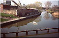
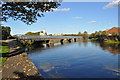
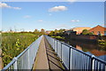
100 photos from this area
Area Information
Key information about the LE3 0SQ including its size, population, and administrative classification.
- Area Type
- Postcode
- Area Size
- 9474 m²
- Population
- 1478
- Population Density
- 6910 people/km²
House Prices in LE3 0SQ
22
Properties
£227,835
Average Sold Price
£42,900
Lowest Price
£490,000
Highest Price
Showing 22 properties
| Address | Type | Beds | Baths | Last Sale Price | Last Sale Date | |
|---|---|---|---|---|---|---|
| 99 Westcotes Drive, Leicester, LE3 0SQ | Semi-detached | 3 | 1 | £315,000 | Aug 2023 | |
| 93 Westcotes Drive, Leicester, LE3 0SQ | Semi-detached | 3 | 1 | £235,000 | Nov 2021 | |
| 79 Westcotes Drive, Leicester, LE3 0SQ | Detached | 4 | 1 | £277,000 | Jun 2021 | |
| 81 Westcotes Drive, Leicester, LE3 0SQ | house | 3 | - | £227,500 | Nov 2020 | |
| 59 Westcotes Drive, Leicester, LE3 0SQ | house | - | - | £490,000 | Jan 2019 | |
| 77 Westcotes Drive, Leicester, LE3 0SQ | Detached | 4 | 3 | £250,000 | Jan 2017 | |
| 73 Westcotes Drive, Leicester, LE3 0SQ | house | - | - | £170,000 | Nov 2016 | |
| 75 Westcotes Drive, Leicester, LE3 0SQ | Detached | 4 | 2 | £260,000 | May 2016 | |
| 67 Westcotes Drive, Leicester, LE3 0SQ | Bungalow | 5 | 2 | £260,000 | Nov 2015 | |
| 71 Westcotes Drive, Leicester, LE3 0SQ | house | - | - | £175,000 | Oct 2013 |
Page 1 of 3
Energy Efficiency in LE3 0SQ
Amenities
Schools
| Rank | School | Type | Entry gender | Ages |
|---|
Explore more schools in this area
Go to Schools tabDemographics
Household Size
One person
most common
Accommodation Type
Houses
most common
Tenure
43
majority
Ethnic Group
White
most common
Religion
N/A
most common
Household Composition
N/A
most common
Age
47
median
Adults (30-64 years)
most common
Household Deprivation
N/A
with no deprivation
NS-SEC
26
in Lower managerial occupations
Explore more demographic insights in this area
Go to Demographics tabPlanning
Planning Constraints
- Flood RiskPremium
- Ramsar Wetland SitesPremium
- Area of Outstanding Natural BeautyPremium
- Protected Nature ReservePremium
- Protected WoodlandPremium