Area Overview for LE3 0SP
Photos of LE3 0SP
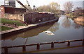
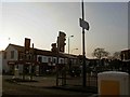
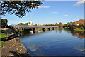
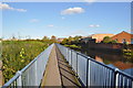
100 photos from this area
Area Information
Key information about the LE3 0SP including its size, population, and administrative classification.
- Area Type
- Postcode
- Area Size
- 7941 m²
- Population
- 1478
- Population Density
- 6910 people/km²
House Prices in LE3 0SP
24
Properties
£193,682
Average Sold Price
£36,000
Lowest Price
£417,500
Highest Price
Showing 24 properties
| Address | Type | Beds | Baths | Last Sale Price | Last Sale Date | |
|---|---|---|---|---|---|---|
| 162 Westcotes Drive, Leicester, LE3 0SP | Semi-detached | 3 | 2 | £308,000 | Mar 2025 | |
| 154 Westcotes Drive, Leicester, LE3 0SP | Detached | 3 | 1 | £417,500 | Oct 2022 | |
| 186 Westcotes Drive, Leicester, LE3 0SP | house | - | - | £190,000 | Feb 2021 | |
| 176 Westcotes Drive, Leicester, LE3 0SP | house | - | - | £240,000 | Jun 2019 | |
| 166 Westcotes Drive, Leicester, LE3 0SP | house | 3 | 1 | £247,000 | May 2017 | |
| 152 Westcotes Drive, Leicester, LE3 0SP | house | - | - | £264,000 | Apr 2017 | |
| 160 Westcotes Drive, Leicester, LE3 0SP | house | - | - | £254,500 | Nov 2016 | |
| 148 Westcotes Drive, Leicester, LE3 0SP | Semi-detached | 4 | - | £245,000 | Jan 2014 | |
| 144 Westcotes Drive, Leicester, LE3 0SP | Semi-detached | 3 | - | £187,000 | Jun 2012 | |
| 146 Westcotes Drive, Leicester, LE3 0SP | house | - | - | £144,000 | May 2012 |
Page 1 of 3
Energy Efficiency in LE3 0SP
Amenities
Schools
| Rank | School | Type | Entry gender | Ages |
|---|
Explore more schools in this area
Go to Schools tabDemographics
Household Size
One person
most common
Accommodation Type
Houses
most common
Tenure
43
majority
Ethnic Group
White
most common
Religion
N/A
most common
Household Composition
N/A
most common
Age
47
median
Adults (30-64 years)
most common
Household Deprivation
N/A
with no deprivation
NS-SEC
26
in Lower managerial occupations
Explore more demographic insights in this area
Go to Demographics tabPlanning
Planning Constraints
- Flood RiskPremium
- Ramsar Wetland SitesPremium
- Area of Outstanding Natural BeautyPremium
- Protected Nature ReservePremium
- Protected WoodlandPremium