Area Overview for LE3 0HB
Photos of LE3 0HB
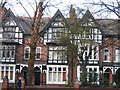
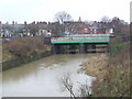
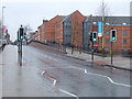
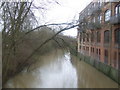
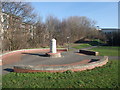
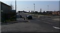
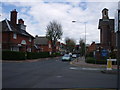
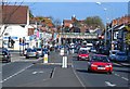
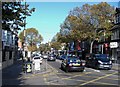
100 photos from this area
Area Information
Key information about the LE3 0HB including its size, population, and administrative classification.
- Area Type
- Postcode
- Area Size
- 7344 m²
- Population
- 1887
- Population Density
- 12951 people/km²
House Prices in LE3 0HB
31
Properties
£205,263
Average Sold Price
£56,500
Lowest Price
£345,000
Highest Price
Showing 31 properties
| Address | Type | Beds | Baths | Last Sale Price | Last Sale Date | |
|---|---|---|---|---|---|---|
| 44 Upperton Road, Leicester, LE3 0HB | Terraced | 4 | 3 | £345,000 | Oct 2025 | |
| 50 Upperton Road, Leicester, LE3 0HB | house | 5 | - | £262,500 | Mar 2021 | |
| Former, 56 Upperton Road, Leicester, LE3 0HB | Terraced | 6 | 2 | £212,000 | Nov 2020 | |
| 38 Upperton Road, Leicester, LE3 0HB | house | 4 | 1 | £260,000 | Jul 2020 | |
| 72 Upperton Road, Leicester, LE3 0HB | Terraced | 1 | 1 | £230,000 | Jan 2020 | |
| 36 Upperton Road, Leicester, LE3 0HB | Terraced | 4 | - | £255,000 | Oct 2019 | |
| 78 Upperton Road, Leicester, LE3 0HB | Terraced | 5 | 2 | £185,000 | Feb 2019 | |
| 74 Upperton Road, Leicester, LE3 0HB | Terraced | 4 | - | £204,000 | Jul 2018 | |
| 34 Upperton Road, Leicester, LE3 0HB | Terraced | 5 | 1 | £240,000 | Oct 2016 | |
| 76 Upperton Road, Leicester, LE3 0HB | Terraced | 4 | - | £182,500 | May 2015 |
Page 1 of 4
Energy Efficiency in LE3 0HB
Amenities
Schools
| Rank | School | Type | Entry gender | Ages |
|---|
Explore more schools in this area
Go to Schools tabDemographics
Household Size
Family (3-5 people)
most common
Accommodation Type
Houses
most common
Tenure
21
majority
Ethnic Group
White
most common
Religion
N/A
most common
Household Composition
N/A
most common
Age
22
median
Young Adults (15-29 years)
most common
Household Deprivation
N/A
with no deprivation
NS-SEC
13
in Lower managerial occupations
Explore more demographic insights in this area
Go to Demographics tabPlanning
Planning Constraints
- Flood RiskPremium
- Ramsar Wetland SitesPremium
- Area of Outstanding Natural BeautyPremium
- Protected Nature ReservePremium
- Protected WoodlandPremium