Area Overview for LE3 0FA
Photos of LE3 0FA
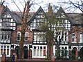
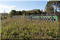
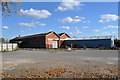
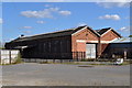
100 photos from this area
Area Information
Key information about the LE3 0FA including its size, population, and administrative classification.
- Area Type
- Postcode
- Area Size
- 1.1 hectares
- Population
- 1887
- Population Density
- 12951 people/km²
House Prices in LE3 0FA
83
Properties
£296,667
Average Sold Price
£91,500
Lowest Price
£621,000
Highest Price
Showing 83 properties
| Address | Type | Beds | Baths | Last Sale Price | Last Sale Date | |
|---|---|---|---|---|---|---|
| Ashleigh Nursing Home, 17 Ashleigh Road, Leicester, LE3 0FA | hospital_care_home | - | - | £621,000 | Jul 2023 | |
| 12 Ashleigh Road, Leicester, LE3 0FA | Terraced | 6 | 2 | £300,000 | Aug 2018 | |
| 14 Ashleigh Road, Leicester, LE3 0FA | Terraced | 6 | 2 | £222,500 | Jul 2009 | |
| 16 Ashleigh Road, Leicester, LE3 0FA | Terraced | 9 | 4 | £275,000 | Aug 2006 | |
| 18 Ashleigh Road, Leicester, LE3 0FA | house | 3 | - | £270,000 | Aug 2005 | |
| 22 Ashleigh Road, Leicester, LE3 0FA | Detached | 5 | 3 | £91,500 | Jul 2001 | |
| 6 Ashleigh Road, Leicester, LE3 0FA | Terraced | 6 | 3 | - | - | |
| Bedsit 5, 15 Ashleigh Road, Leicester, LE3 0FA | Unknown | - | - | - | - | |
| Bedsit 6, 15 Ashleigh Road, Leicester, LE3 0FA | Unknown | - | - | - | - | |
| Bedsit 7, 15 Ashleigh Road, Leicester, LE3 0FA | Unknown | - | - | - | - |
Page 1 of 9
Energy Efficiency in LE3 0FA
Amenities
Schools
| Rank | School | Type | Entry gender | Ages |
|---|
Explore more schools in this area
Go to Schools tabDemographics
Household Size
Family (3-5 people)
most common
Accommodation Type
Houses
most common
Tenure
21
majority
Ethnic Group
White
most common
Religion
N/A
most common
Household Composition
N/A
most common
Age
22
median
Young Adults (15-29 years)
most common
Household Deprivation
N/A
with no deprivation
NS-SEC
13
in Lower managerial occupations
Explore more demographic insights in this area
Go to Demographics tabPlanning
Planning Constraints
- Flood RiskPremium
- Ramsar Wetland SitesPremium
- Area of Outstanding Natural BeautyPremium
- Protected Nature ReservePremium
- Protected WoodlandPremium