Area Overview for LE2 9FA
Photos of LE2 9FA
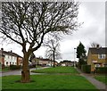
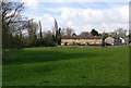
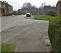
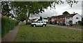
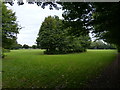
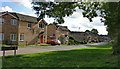
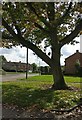
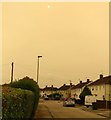
33 photos from this area
Area Information
Key information about the LE2 9FA including its size, population, and administrative classification.
- Area Type
- Postcode
- Area Size
- 5133 m²
- Population
- 1556
- Population Density
- 4984 people/km²
House Prices in LE2 9FA
20
Properties
£130,750
Average Sold Price
£62,000
Lowest Price
£175,000
Highest Price
Showing 20 properties
| Address | Type | Beds | Baths | Last Sale Price | Last Sale Date | |
|---|---|---|---|---|---|---|
| 102 Ambleside Drive, Leicester, LE2 9FA | Terraced | 3 | 1 | £175,000 | Jan 2023 | |
| 92 Ambleside Drive, Leicester, LE2 9FA | house | - | - | £165,500 | Jun 2021 | |
| 82 Ambleside Drive, Leicester, LE2 9FA | Terraced | 3 | 1 | £140,000 | Nov 2018 | |
| 96 Ambleside Drive, Leicester, LE2 9FA | Terraced | 3 | 1 | £133,000 | Oct 2018 | |
| 112 Ambleside Drive, Leicester, LE2 9FA | house | - | - | £109,000 | Apr 2015 | |
| 90 Ambleside Drive, Leicester, LE2 9FA | Terraced | - | - | £62,000 | Sep 2002 | |
| 100 Ambleside Drive, Leicester, LE2 9FA | Retail | 3 | 1 | - | - | |
| 78 Ambleside Drive, Leicester, LE2 9FA | house | 2 | - | - | - | |
| 108 Ambleside Drive, Leicester, LE2 9FA | Terraced | - | - | - | - | |
| 116 Ambleside Drive, Leicester, LE2 9FA | house | - | - | - | - |
Page 1 of 2
Energy Efficiency in LE2 9FA
Amenities
Schools
| Rank | School | Type | Entry gender | Ages |
|---|
Explore more schools in this area
Go to Schools tabDemographics
Household Size
One person
most common
Accommodation Type
Houses
most common
Tenure
32
majority
Ethnic Group
White
most common
Religion
N/A
most common
Household Composition
N/A
most common
Age
47
median
Adults (30-64 years)
most common
Household Deprivation
N/A
with no deprivation
NS-SEC
12
in Lower managerial occupations
Explore more demographic insights in this area
Go to Demographics tabPlanning
Planning Constraints
- Flood RiskPremium
- Ramsar Wetland SitesPremium
- Area of Outstanding Natural BeautyPremium
- Protected Nature ReservePremium
- Protected WoodlandPremium