Area Overview for LE2 8RE
Photos of LE2 8RE
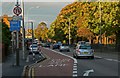
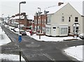
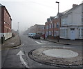
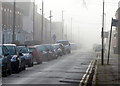
100 photos from this area
Area Information
Key information about the LE2 8RE including its size, population, and administrative classification.
- Area Type
- Postcode
- Area Size
- 4666 m²
- Population
- 1726
- Population Density
- 6777 people/km²
House Prices in LE2 8RE
15
Properties
£122,145
Average Sold Price
£43,000
Lowest Price
£200,000
Highest Price
Showing 15 properties
| Address | Type | Beds | Baths | Last Sale Price | Last Sale Date | |
|---|---|---|---|---|---|---|
| 21 St Andrews Road, Leicester, LE2 8RE | Semi-detached | 2 | 1 | £200,000 | Nov 2022 | |
| 27 St Andrews Road, Leicester, LE2 8RE | house | 3 | 1 | £200,000 | Nov 2019 | |
| 9 St Andrews Road, Leicester, LE2 8RE | house | 2 | 1 | £136,000 | Feb 2019 | |
| 37 St Andrews Road, Leicester, LE2 8RE | Semi-detached | 3 | 1 | £140,000 | Nov 2016 | |
| 7 St Andrews Road, Leicester, LE2 8RE | house | 3 | - | £107,000 | Oct 2015 | |
| 35 St Andrews Road, Leicester, LE2 8RE | Terraced | - | - | £122,000 | Sep 2007 | |
| 39 St Andrews Road, Leicester, LE2 8RE | Terraced | 3 | 1 | £123,500 | Aug 2007 | |
| 23A St Andrews Road, Leicester, LE2 8RE | Semi-detached | - | - | £60,000 | Sep 2006 | |
| 3 St Andrews Road, Leicester, LE2 8RE | house | 3 | - | £89,950 | Nov 2003 | |
| 41 St Andrews Road, Leicester, LE2 8RE | Detached | - | - | £43,000 | Jan 1997 |
Page 1 of 2
Energy Efficiency in LE2 8RE
Amenities
Schools
| Rank | School | Type | Entry gender | Ages |
|---|
Explore more schools in this area
Go to Schools tabDemographics
Household Size
Two person
most common
Accommodation Type
Houses
most common
Tenure
54
majority
Ethnic Group
White
most common
Religion
N/A
most common
Household Composition
N/A
most common
Age
47
median
Adults (30-64 years)
most common
Household Deprivation
N/A
with no deprivation
NS-SEC
27
in Lower managerial occupations
Explore more demographic insights in this area
Go to Demographics tabPlanning
Planning Constraints
- Flood RiskPremium
- Ramsar Wetland SitesPremium
- Area of Outstanding Natural BeautyPremium
- Protected Nature ReservePremium
- Protected WoodlandPremium