Area Overview for LE2 8QY
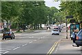
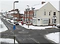
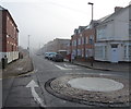
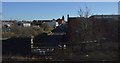
Photos of LE2 8QY


Area Information
Living in LE2 8QY means inhabiting a compact, residential cluster in England’s East Midlands, where density and proximity define daily life. The area spans 4,495 square metres and is home to 1,726 residents, translating to a population density of 384,000 people per square kilometre. This high density suggests a tightly woven community, though the area’s small size means it is likely a single, cohesive neighbourhood rather than a sprawling suburb. Its location offers practical access to nearby retail, rail, and transport hubs, including Leicester Railway Station and Leicester Airport. While the area lacks natural landscapes or protected sites, its compactness ensures amenities are within walking or cycling distance. For those prioritising convenience over open space, LE2 8QY provides a mix of urban accessibility and residential tranquility, though its character is shaped by the rhythms of a small, closely knit population.
- Area Type
- Postcode
- Area Size
- 4495 m²
- Population
- 1726
- Population Density
- 6777 people/km²
The property market in LE2 8QY is shaped by its compact size and focus on houses rather than flats. With 54% of residents owning their homes, the area leans towards owner-occupation, though the small population suggests limited housing stock. The predominance of houses may cater to buyers seeking larger living spaces, but the area’s size means opportunities for expansion are constrained. Proximity to Leicester’s transport hubs, including rail and metro links, could make it attractive to commuters. However, the high population density within a small footprint may limit availability, particularly for first-time buyers. Those considering the area should weigh its practical connectivity against the potential scarcity of properties, especially in a competitive market.
House Prices in LE2 8QY
No properties found in this postcode.
Energy Efficiency in LE2 8QY
Daily life in LE2 8QY is supported by a range of nearby amenities. Retail options include Tesco Leicester, Heron Aylestone, and Spar, providing essentials within practical reach. The area’s rail and metro connections—South Wigston, Leicester Railway Station, Leicester North, and Great Central Railway—offer easy access to Leicester’s business districts, cultural hubs, and beyond. Leicester Airport is also within reach, catering to those with travel needs. While the data does not mention parks or leisure facilities, the presence of multiple transport links and retail spots suggests a focus on practicality over leisure. The compact nature of the area means residents can access shops, transport, and travel hubs without long commutes, though the absence of detailed information on green spaces leaves room for further inquiry.
Amenities
Schools
| Rank | School | Type | Entry gender | Ages |
|---|
Explore more schools in this area
Go to Schools tabDemographics
The community in LE2 8QY is predominantly middle-aged, with a median age of 47 and the most common age range being adults aged 30–64. This suggests a population focused on established careers and family life, with fewer young families or retirees. Home ownership sits at 54%, indicating a mix of owner-occupied properties and rental units. The area is characterised by houses rather than flats, which may appeal to those seeking more space or privacy. The predominant ethnic group is White, though specific data on diversity or deprivation is not provided. The high population density, combined with a mature demographic, implies a stable, long-term resident base. However, the lack of detailed socio-economic data means broader conclusions about quality of life remain speculative.
Household Size
Accommodation Type
Tenure
Ethnic Group
Religion
Household Composition
Age
Household Deprivation
NS-SEC
Explore more demographic insights in this area
Go to Demographics tabPlanning
Planning Constraints
- Flood RiskPremium
- Ramsar Wetland SitesPremium
- Area of Outstanding Natural BeautyPremium
- Protected Nature ReservePremium
- Protected WoodlandPremium