Area Overview for LE2 3TN
Photos of LE2 3TN
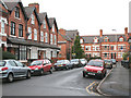
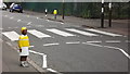
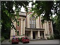
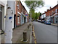
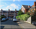
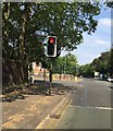
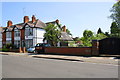
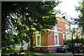
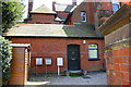
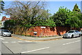
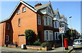
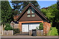
61 photos from this area
Area Information
Key information about the LE2 3TN including its size, population, and administrative classification.
- Area Type
- Postcode
- Area Size
- 1.9 hectares
- Population
- 1636
- Population Density
- 5002 people/km²
House Prices in LE2 3TN
19
Properties
£480,723
Average Sold Price
£138,000
Lowest Price
£810,000
Highest Price
Showing 19 properties
| Address | Type | Beds | Baths | Last Sale Price | Last Sale Date | |
|---|---|---|---|---|---|---|
| 35 Southernhay Road, Leicester, LE2 3TN | Detached | 5 | 2 | £640,000 | May 2024 | |
| 13 Southernhay Road, Leicester, LE2 3TN | house | - | - | £810,000 | Nov 2022 | |
| 15 Southernhay Road, Leicester, LE2 3TN | Retail | 3 | 3 | £550,000 | Oct 2022 | |
| 17 Southernhay Road, Leicester, LE2 3TN | Detached | 5 | 2 | £615,000 | Aug 2015 | |
| 31 Southernhay Road, Leicester, LE2 3TN | Detached | 4 | - | £404,000 | Aug 2014 | |
| 5 Southernhay Road, Leicester, LE2 3TN | house | 4 | - | £499,500 | Aug 2010 | |
| 23 Southernhay Road, Leicester, LE2 3TN | house | 3 | - | £335,175 | Mar 2010 | |
| 3 Southernhay Road, Leicester, LE2 3TN | Detached | - | - | £627,000 | Aug 2008 | |
| 9 Southernhay Road, Leicester, LE2 3TN | house | - | - | £635,000 | Aug 2004 | |
| 33 Southernhay Road, Leicester, LE2 3TN | Detached | - | - | £285,000 | Aug 2002 |
Page 1 of 2
Energy Efficiency in LE2 3TN
Amenities
Schools
| Rank | School | Type | Entry gender | Ages |
|---|
Explore more schools in this area
Go to Schools tabDemographics
Household Size
One person
most common
Accommodation Type
Flats
most common
Tenure
44
majority
Ethnic Group
White
most common
Religion
N/A
most common
Household Composition
N/A
most common
Age
47
median
Adults (30-64 years)
most common
Household Deprivation
N/A
with no deprivation
NS-SEC
42
in Lower managerial occupations
Explore more demographic insights in this area
Go to Demographics tabPlanning
Planning Constraints
- Flood RiskPremium
- Ramsar Wetland SitesPremium
- Area of Outstanding Natural BeautyPremium
- Protected Nature ReservePremium
- Protected WoodlandPremium