Area Overview for LE2 3TJ
Photos of LE2 3TJ
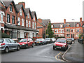
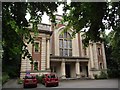
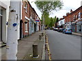
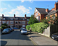
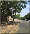
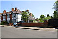
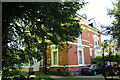
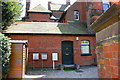
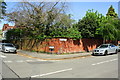
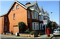
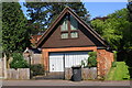
61 photos from this area
Area Information
Key information about the LE2 3TJ including its size, population, and administrative classification.
- Area Type
- Postcode
- Area Size
- 2.3 hectares
- Population
- 1636
- Population Density
- 5002 people/km²
House Prices in LE2 3TJ
23
Properties
£572,923
Average Sold Price
£345,000
Lowest Price
£975,000
Highest Price
Showing 23 properties
| Address | Type | Beds | Baths | Last Sale Price | Last Sale Date | |
|---|---|---|---|---|---|---|
| 20 Southernhay Road, Leicester, LE2 3TJ | Detached | 5 | 3 | £974,000 | May 2024 | |
| 2A Southernhay Road, Leicester, LE2 3TJ | house | - | - | £975,000 | Dec 2023 | |
| 42 Southernhay Road, Leicester, LE2 3TJ | house | - | - | £652,500 | Jun 2023 | |
| 14 Southernhay Road, Leicester, LE2 3TJ | house | - | - | £345,000 | Nov 2019 | |
| 12 Southernhay Road, Leicester, LE2 3TJ | Detached | 5 | 1 | £607,000 | Oct 2019 | |
| 28 Southernhay Road, Leicester, LE2 3TJ | house | - | - | £650,000 | Aug 2017 | |
| 26 Southernhay Road, Leicester, LE2 3TJ | house | - | - | £447,000 | Jun 2013 | |
| 16 Southernhay Road, Leicester, LE2 3TJ | house | 4 | - | £480,000 | Aug 2011 | |
| 32 Southernhay Road, Leicester, LE2 3TJ | house | 4 | - | £450,000 | May 2010 | |
| 36 Southernhay Road, Leicester, LE2 3TJ | Detached | - | - | £517,500 | Apr 2007 |
Page 1 of 3
Energy Efficiency in LE2 3TJ
Amenities
Schools
| Rank | School | Type | Entry gender | Ages |
|---|
Explore more schools in this area
Go to Schools tabDemographics
Household Size
One person
most common
Accommodation Type
Flats
most common
Tenure
44
majority
Ethnic Group
White
most common
Religion
N/A
most common
Household Composition
N/A
most common
Age
47
median
Adults (30-64 years)
most common
Household Deprivation
N/A
with no deprivation
NS-SEC
42
in Lower managerial occupations
Explore more demographic insights in this area
Go to Demographics tabPlanning
Planning Constraints
- Flood RiskPremium
- Ramsar Wetland SitesPremium
- Area of Outstanding Natural BeautyPremium
- Protected Nature ReservePremium
- Protected WoodlandPremium