Area Overview for LE2 2LE
Photos of LE2 2LE
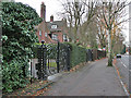
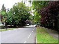
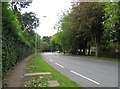
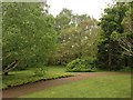
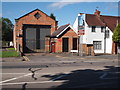
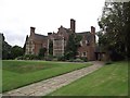
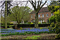
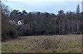
70 photos from this area
Area Information
Key information about the LE2 2LE including its size, population, and administrative classification.
- Area Type
- Postcode
- Area Size
- 4.7 hectares
- Population
- 2590
- Population Density
- 2039 people/km²
House Prices in LE2 2LE
20
Properties
£616,042
Average Sold Price
£160,000
Lowest Price
£1,375,000
Highest Price
Showing 20 properties
| Address | Type | Beds | Baths | Last Sale Price | Last Sale Date | |
|---|---|---|---|---|---|---|
| 28 Knighton Grange Road, Oadby, LE2 2LE | house | - | - | £1,375,000 | Mar 2021 | |
| 18 Knighton Grange Road, Oadby, LE2 2LE | house | 5 | - | £855,000 | Jun 2014 | |
| 6 Knighton Grange Road, Leicester, LE2 2LE | Detached | 5 | 1 | £855,000 | Oct 2013 | |
| 16 Knighton Grange Road, Oadby, LE2 2LE | Detached | - | - | £900,000 | Feb 2007 | |
| 22 Knighton Grange Road, Oadby, LE2 2LE | Detached | - | - | £560,000 | Aug 2005 | |
| 30 Knighton Grange Road, Oadby, LE2 2LE | Detached | - | - | £650,000 | Feb 2003 | |
| 14 Knighton Grange Road, Oadby, LE2 2LE | house | - | - | £510,000 | Dec 2001 | |
| 12 Knighton Grange Road, Oadby, LE2 2LE | Detached | - | - | £430,000 | Sep 2000 | |
| 20 Knighton Grange Road, Oadby, LE2 2LE | Detached | - | - | £475,000 | Jan 2000 | |
| 34 Knighton Grange Road, Oadby, LE2 2LE | house | 4 | - | £160,000 | Sep 1999 |
Page 1 of 2
Energy Efficiency in LE2 2LE
Amenities
Schools
| Rank | School | Type | Entry gender | Ages |
|---|
Explore more schools in this area
Go to Schools tabDemographics
Household Size
Family (3-5 people)
most common
Accommodation Type
Houses
most common
Tenure
93
majority
Ethnic Group
asian_total
most common
Religion
N/A
most common
Household Composition
N/A
most common
Age
22
median
Young Adults (15-29 years)
most common
Household Deprivation
N/A
with no deprivation
NS-SEC
29
in Lower managerial occupations
Explore more demographic insights in this area
Go to Demographics tabPlanning
Planning Constraints
- Flood RiskPremium
- Ramsar Wetland SitesPremium
- Area of Outstanding Natural BeautyPremium
- Protected Nature ReservePremium
- Protected WoodlandPremium