Area Overview for LE2 2EH
Photos of LE2 2EH
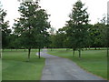
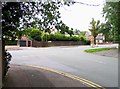
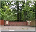
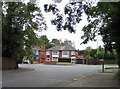
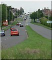
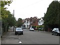
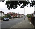
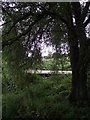
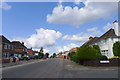
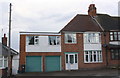
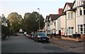
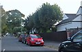
39 photos from this area
Area Information
Key information about the LE2 2EH including its size, population, and administrative classification.
- Area Type
- Postcode
- Area Size
- 1.7 hectares
- Population
- 1300
- Population Density
- 3860 people/km²
House Prices in LE2 2EH
28
Properties
£345,235
Average Sold Price
£210,000
Lowest Price
£562,600
Highest Price
Showing 28 properties
| Address | Type | Beds | Baths | Last Sale Price | Last Sale Date | |
|---|---|---|---|---|---|---|
| 23 Westminster Road, Leicester, LE2 2EH | house | 3 | - | £562,600 | Jan 2023 | |
| 51 Westminster Road, Leicester, LE2 2EH | Semi-detached | - | - | £425,000 | Jun 2021 | |
| 39 Westminster Road, Leicester, LE2 2EH | Semi-detached | 4 | 2 | £560,000 | Mar 2021 | |
| 1 Westminster Road, Leicester, LE2 2EH | Semi-detached | 5 | - | £310,000 | Mar 2018 | |
| 5 Westminster Road, Leicester, LE2 2EH | Semi-detached | - | - | £370,000 | Nov 2016 | |
| 55 Westminster Road, Leicester, LE2 2EH | Semi-detached | 4 | 1 | £330,000 | Aug 2015 | |
| 3 Westminster Road, Leicester, LE2 2EH | Semi-detached | 5 | 2 | £342,900 | Jan 2015 | |
| 25 Westminster Road, Leicester, LE2 2EH | Semi-detached | 4 | 2 | £285,000 | Jul 2014 | |
| 13 Westminster Road, Leicester, LE2 2EH | Detached | 4 | 2 | £495,000 | Nov 2013 | |
| 19 Westminster Road, Leicester, LE2 2EH | Semi-detached | 4 | - | £340,000 | Oct 2013 |
Page 1 of 3
Energy Efficiency in LE2 2EH
Amenities
Schools
| Rank | School | Type | Entry gender | Ages |
|---|
Explore more schools in this area
Go to Schools tabDemographics
Household Size
One person
most common
Accommodation Type
Houses
most common
Tenure
70
majority
Ethnic Group
White
most common
Religion
N/A
most common
Household Composition
N/A
most common
Age
47
median
Adults (30-64 years)
most common
Household Deprivation
N/A
with no deprivation
NS-SEC
46
in Lower managerial occupations
Explore more demographic insights in this area
Go to Demographics tabPlanning
Planning Constraints
- Flood RiskPremium
- Ramsar Wetland SitesPremium
- Area of Outstanding Natural BeautyPremium
- Protected Nature ReservePremium
- Protected WoodlandPremium