Area Overview for LE19 4NY
Photos of LE19 4NY
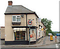
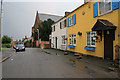
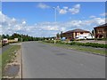
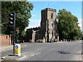
38 photos from this area
Area Information
Key information about the LE19 4NY including its size, population, and administrative classification.
- Area Type
- Postcode
- Area Size
- 8772 m²
- Population
- 2542
- Population Density
- 298 people/km²
House Prices in LE19 4NY
39
Properties
£135,600
Average Sold Price
£20,000
Lowest Price
£350,000
Highest Price
Showing 39 properties
| Address | Type | Beds | Baths | Last Sale Price | Last Sale Date | |
|---|---|---|---|---|---|---|
| 2 Rawson Street, Enderby, LE19 4NY | Terraced | 2 | 1 | £230,500 | Mar 2025 | |
| Salem House, Rawson Street, Enderby, LE19 4NY | Detached | 4 | 1 | £350,000 | Aug 2024 | |
| 15 Rawson Street, Enderby, LE19 4NY | Terraced | 2 | - | £175,000 | Mar 2022 | |
| 28 Rawson Street, Enderby, LE19 4NY | Terraced | 2 | 1 | £175,000 | Jan 2022 | |
| 19 Rawson Street, Enderby, LE19 4NY | Terraced | 3 | - | £182,000 | Apr 2021 | |
| 9 Rawson Street, Enderby, LE19 4NY | Terraced | 2 | 1 | £160,000 | Oct 2020 | |
| 26 Rawson Street, Enderby, LE19 4NY | Terraced | 2 | - | £180,000 | Aug 2020 | |
| 25 Rawson Street, Enderby, LE19 4NY | Detached | 4 | 2 | £104,000 | Mar 2020 | |
| 18 Rawson Street, Enderby, LE19 4NY | Terraced | 2 | 1 | £165,000 | Jan 2020 | |
| 30 Rawson Street, Enderby, LE19 4NY | Terraced | 2 | - | £159,500 | Oct 2019 |
Page 1 of 4
Energy Efficiency in LE19 4NY
Amenities
Schools
| Rank | School | Type | Entry gender | Ages |
|---|
Explore more schools in this area
Go to Schools tabDemographics
Household Size
Family (3-5 people)
most common
Accommodation Type
Houses
most common
Tenure
77
majority
Ethnic Group
White
most common
Religion
N/A
most common
Household Composition
N/A
most common
Age
47
median
Adults (30-64 years)
most common
Household Deprivation
N/A
with no deprivation
NS-SEC
44
in Lower managerial occupations
Explore more demographic insights in this area
Go to Demographics tabPlanning
Planning Constraints
- Flood RiskPremium
- Ramsar Wetland SitesPremium
- Area of Outstanding Natural BeautyPremium
- Protected Nature ReservePremium
- Protected WoodlandPremium