Area Overview for LE19 4NG
Photos of LE19 4NG

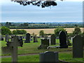
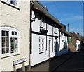
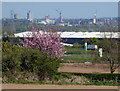
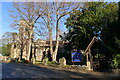
38 photos from this area
Area Information
Key information about the LE19 4NG including its size, population, and administrative classification.
- Area Type
- Postcode
- Area Size
- 1.1 hectares
- Population
- 2542
- Population Density
- 298 people/km²
House Prices in LE19 4NG
26
Properties
£181,461
Average Sold Price
£51,000
Lowest Price
£378,000
Highest Price
Showing 26 properties
| Address | Type | Beds | Baths | Last Sale Price | Last Sale Date | |
|---|---|---|---|---|---|---|
| 6 Co Operation Street, Enderby, LE19 4NG | Terraced | 2 | - | £225,000 | Dec 2025 | |
| 13 Co Operation Street, Enderby, LE19 4NG | Terraced | 2 | 1 | £248,000 | Aug 2024 | |
| 28 Co Operation Street, Enderby, LE19 4NG | Flat | - | - | £140,000 | Aug 2022 | |
| 2 Co Operation Street, Enderby, LE19 4NG | house | 3 | - | £378,000 | Mar 2022 | |
| 7 Co Operation Street, Enderby, LE19 4NG | Detached | 3 | 1 | £300,000 | Jan 2021 | |
| 20 Co Operation Street, Enderby, LE19 4NG | Flat | 2 | 2 | £170,000 | Oct 2020 | |
| 16 Co Operation Street, Enderby, LE19 4NG | Maisonette | - | - | £192,000 | Jan 2020 | |
| 3 Co Operation Street, Enderby, LE19 4NG | Detached | 3 | 2 | £201,000 | Jan 2018 | |
| 8 Co Operation Street, Enderby, LE19 4NG | Terraced | 2 | - | £140,000 | Jan 2016 | |
| 9 Co Operation Street, Enderby, LE19 4NG | Terraced | 4 | 2 | £218,000 | Feb 2015 |
Page 1 of 3
Energy Efficiency in LE19 4NG
Amenities
Schools
| Rank | School | Type | Entry gender | Ages |
|---|
Explore more schools in this area
Go to Schools tabDemographics
Household Size
Family (3-5 people)
most common
Accommodation Type
Houses
most common
Tenure
77
majority
Ethnic Group
White
most common
Religion
N/A
most common
Household Composition
N/A
most common
Age
47
median
Adults (30-64 years)
most common
Household Deprivation
N/A
with no deprivation
NS-SEC
44
in Lower managerial occupations
Explore more demographic insights in this area
Go to Demographics tabPlanning
Planning Constraints
- Flood RiskPremium
- Ramsar Wetland SitesPremium
- Area of Outstanding Natural BeautyPremium
- Protected Nature ReservePremium
- Protected WoodlandPremium