Area Overview for LE19 3XP
Photos of LE19 3XP
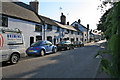
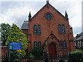
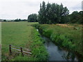
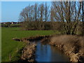
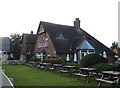
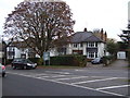
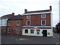
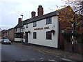
29 photos from this area
Area Information
Key information about the LE19 3XP including its size, population, and administrative classification.
- Area Type
- Postcode
- Area Size
- 6287 m²
- Population
- 1847
- Population Density
- 1696 people/km²
House Prices in LE19 3XP
19
Properties
£105,433
Average Sold Price
£56,000
Lowest Price
£178,000
Highest Price
Showing 19 properties
| Address | Type | Beds | Baths | Last Sale Price | Last Sale Date | |
|---|---|---|---|---|---|---|
| 17 Oaks Court, Narborough, LE19 3XP | Terraced | 2 | 1 | £178,000 | May 2024 | |
| 8 Oaks Court, Narborough, LE19 3XP | house | - | - | £154,000 | Jul 2022 | |
| 3 Oaks Court, Narborough, LE19 3XP | house | - | - | £152,500 | Oct 2020 | |
| 7 Oaks Court, Narborough, LE19 3XP | Terraced | 2 | 1 | £120,000 | Dec 2016 | |
| 20 Oaks Court, Narborough, LE19 3XP | house | 2 | - | £120,000 | Nov 2016 | |
| 14 Oaks Court, Narborough, LE19 3XP | house | 2 | - | £96,000 | Oct 2009 | |
| 12 Oaks Court, Narborough, LE19 3XP | Semi-detached | 2 | 1 | £112,000 | Jul 2007 | |
| 6 Oaks Court, Narborough, LE19 3XP | house | - | - | £108,000 | Jan 2007 | |
| 1 Oaks Court, Narborough, LE19 3XP | house | - | - | £114,500 | Nov 2006 | |
| 15 Oaks Court, Narborough, LE19 3XP | house | 2 | - | £105,000 | Aug 2006 |
Page 1 of 2
Energy Efficiency in LE19 3XP
Amenities
Schools
| Rank | School | Type | Entry gender | Ages |
|---|
Explore more schools in this area
Go to Schools tabDemographics
Household Size
Two person
most common
Accommodation Type
Houses
most common
Tenure
85
majority
Ethnic Group
White
most common
Religion
N/A
most common
Household Composition
N/A
most common
Age
47
median
Adults (30-64 years)
most common
Household Deprivation
N/A
with no deprivation
NS-SEC
43
in Lower managerial occupations
Explore more demographic insights in this area
Go to Demographics tabPlanning
Planning Constraints
- Flood RiskPremium
- Ramsar Wetland SitesPremium
- Area of Outstanding Natural BeautyPremium
- Protected Nature ReservePremium
- Protected WoodlandPremium