Area Overview for LE19 3EF
Photos of LE19 3EF
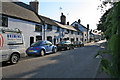

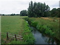
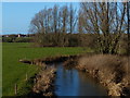
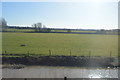
29 photos from this area
Area Information
Key information about the LE19 3EF including its size, population, and administrative classification.
- Area Type
- Postcode
- Area Size
- 4.1 hectares
- Population
- 1630
- Population Density
- 2195 people/km²
House Prices in LE19 3EF
44
Properties
£222,043
Average Sold Price
£50,000
Lowest Price
£490,000
Highest Price
Showing 44 properties
| Address | Type | Beds | Baths | Last Sale Price | Last Sale Date | |
|---|---|---|---|---|---|---|
| 31 Copt Oak Road, Narborough, LE19 3EF | Detached | 4 | 2 | £490,000 | Mar 2025 | |
| 3 Copt Oak Road, Narborough, LE19 3EF | Bungalow | 4 | 1 | £360,000 | Aug 2024 | |
| 17 Copt Oak Road, Narborough, LE19 3EF | Bungalow | 3 | 1 | £282,500 | Mar 2024 | |
| 25 Copt Oak Road, Narborough, LE19 3EF | Bungalow | 3 | - | £307,000 | Feb 2022 | |
| 10 Copt Oak Road, Narborough, LE19 3EF | Detached | 4 | - | £450,000 | Aug 2020 | |
| 44 Copt Oak Road, Narborough, LE19 3EF | house | - | - | £260,000 | Nov 2019 | |
| 14A Copt Oak Road, Narborough, LE19 3EF | house | - | - | £400,000 | Mar 2019 | |
| 1 Copt Oak Road, Narborough, LE19 3EF | Detached | 3 | - | £360,000 | Jan 2018 | |
| 37 Copt Oak Road, Narborough, LE19 3EF | Detached | 4 | - | £390,000 | Oct 2017 | |
| 20 Copt Oak Road, Narborough, LE19 3EF | Semi-detached | 3 | - | £219,950 | Aug 2017 |
Page 1 of 5
Energy Efficiency in LE19 3EF
Amenities
Schools
| Rank | School | Type | Entry gender | Ages |
|---|
Explore more schools in this area
Go to Schools tabDemographics
Household Size
Family (3-5 people)
most common
Accommodation Type
Houses
most common
Tenure
80
majority
Ethnic Group
White
most common
Religion
N/A
most common
Household Composition
N/A
most common
Age
47
median
Adults (30-64 years)
most common
Household Deprivation
N/A
with no deprivation
NS-SEC
37
in Lower managerial occupations
Explore more demographic insights in this area
Go to Demographics tabPlanning
Planning Constraints
- Flood RiskPremium
- Ramsar Wetland SitesPremium
- Area of Outstanding Natural BeautyPremium
- Protected Nature ReservePremium
- Protected WoodlandPremium