Area Overview for LE17 4RJ
Photos of LE17 4RJ
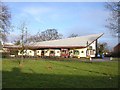
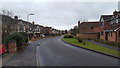
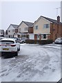
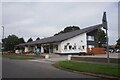


16 photos from this area
Area Information
Key information about the LE17 4RJ including its size, population, and administrative classification.
- Area Type
- Postcode
- Area Size
- 9686 m²
- Population
- 1559
- Population Density
- 2076 people/km²
House Prices in LE17 4RJ
17
Properties
£215,393
Average Sold Price
£59,000
Lowest Price
£310,000
Highest Price
Showing 17 properties
| Address | Type | Beds | Baths | Last Sale Price | Last Sale Date | |
|---|---|---|---|---|---|---|
| 56 Holly Drive, Lutterworth, LE17 4RJ | Bungalow | 3 | 2 | £278,000 | Oct 2025 | |
| 42 Holly Drive, Lutterworth, LE17 4RJ | Detached | 3 | 1 | £280,000 | Jul 2024 | |
| 44 Holly Drive, Lutterworth, LE17 4RJ | Detached | 3 | 1 | £310,000 | Nov 2022 | |
| 28 Holly Drive, Lutterworth, LE17 4RJ | Detached | 3 | 1 | £290,000 | Nov 2022 | |
| 40 Holly Drive, Lutterworth, LE17 4RJ | Detached | 3 | 2 | £260,000 | Nov 2018 | |
| 50 Holly Drive, Lutterworth, LE17 4RJ | Bungalow | 3 | 2 | £290,000 | Jan 2018 | |
| 46 Holly Drive, Lutterworth, LE17 4RJ | Detached | 3 | - | £220,000 | May 2017 | |
| 52 Holly Drive, Lutterworth, LE17 4RJ | Bungalow | - | - | £226,500 | Nov 2016 | |
| 58 Holly Drive, Lutterworth, LE17 4RJ | Bungalow | 3 | 1 | £184,000 | Dec 2011 | |
| 54 Holly Drive, Lutterworth, LE17 4RJ | Bungalow | 3 | - | £165,000 | Dec 2010 |
Page 1 of 2
Energy Efficiency in LE17 4RJ
Amenities
Schools
| Rank | School | Type | Entry gender | Ages |
|---|
Explore more schools in this area
Go to Schools tabDemographics
Household Size
Family (3-5 people)
most common
Accommodation Type
Houses
most common
Tenure
55
majority
Ethnic Group
White
most common
Religion
N/A
most common
Household Composition
N/A
most common
Age
47
median
Adults (30-64 years)
most common
Household Deprivation
N/A
with no deprivation
NS-SEC
23
in Lower managerial occupations
Explore more demographic insights in this area
Go to Demographics tabPlanning
Planning Constraints
- Flood RiskPremium
- Ramsar Wetland SitesPremium
- Area of Outstanding Natural BeautyPremium
- Protected Nature ReservePremium
- Protected WoodlandPremium