Area Overview for LE17 4EW
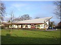
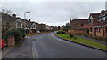
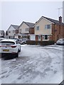
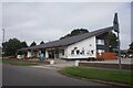
Photos of LE17 4EW

Area Information
Living in LE17 4EW means inhabiting a compact, densely populated residential cluster in England. The area covers just 1.7 hectares, yet it hosts 1,559 residents, translating to a population density of 91,599 people per square kilometre. This small postcode area is defined by its proximity to essential services and amenities, making it a practical choice for those prioritising convenience. The community is anchored by a mix of primary and secondary schools, including Lutterworth College and Sir Frank Whittle Studio School, which cater to local families. Nearby, retail options like Co-op Linden, Morrisons Lutterworth, and Waitrose Lutterworth offer daily essentials, while Rugby Railway Station provides rail connectivity. The area’s compact size means residents can access these facilities within short distances, fostering a sense of cohesion. With a median age of 47 and a population skewed toward adults aged 30–64, LE17 4EW reflects a mature, stable community. Its low crime risk and minimal environmental constraints, such as no protected woodlands or Ramsar sites, suggest a practical, low-stress living environment for those seeking a manageable, well-served postcode.
- Area Type
- Postcode
- Area Size
- 1.7 hectares
- Population
- 1559
- Population Density
- 2076 people/km²
The property market in LE17 4EW is dominated by owner-occupied homes, with 55% of residents owning their properties. The primary accommodation type is houses, which is unusual for a small postcode area but may reflect a focus on family-friendly housing. Given the high population density of 91,599 people per square kilometre, the limited land area suggests a tightly packed housing stock, likely centred on single-family homes. This configuration may make the area less suited to rental investors, as the market appears to prioritise long-term ownership. Buyers should consider the compact nature of the area, which means property choices are constrained to a small geographic footprint. The absence of detailed price data or development plans means the market’s potential for growth or change remains unclear. However, the low crime risk and proximity to essential services may appeal to those seeking a secure, established environment with minimal environmental constraints.
House Prices in LE17 4EW
Showing 2 properties
| Address | Type | Beds | Baths | Last Sale Price | Last Sale Date | |
|---|---|---|---|---|---|---|
| Tennis 66M From Waterworks House, Bitteswell Road 62M From Waterworks Lane, Waterworks Lane, Lutterworth, LE17 4EW | Leisure | - | - | - | - | |
| Little Rainbows Community Preschool And Nursery, Lutterworth Grammar School And Community College, Greenacres Drive, Lutterworth, LE17 4EW | commercial | - | - | - | - |
Energy Efficiency in LE17 4EW
The lifestyle in LE17 4EW is shaped by its proximity to retail and transport hubs. Local shops such as Co-op Linden, Morrisons Lutterworth, and Waitrose Lutterworth provide access to groceries, household goods, and dining options, reducing the need for long trips. The Rugby Railway Station adds convenience for those requiring rail travel, though no details on nearby leisure or green spaces are included. The area’s small size means amenities are tightly clustered, fostering a sense of accessibility. However, the lack of named parks or recreational facilities in the data leaves gaps in understanding the area’s leisure offerings. For residents, the mix of retail and transport options supports a practical, convenience-driven lifestyle. The absence of cultural or entertainment venues means the area may appeal more to those prioritising functional living over diverse recreational opportunities.
Amenities
Schools
Residents of LE17 4EW have access to a range of educational institutions, including Lutterworth College, which operates both as a primary school and an academy with a good Ofsted rating. This dual role ensures continuity for families with children of varying ages. The secondary school, Sir Frank Whittle Studio School, provides further education options for older students. The presence of both primary and secondary schools within the area reduces the need for long commutes, making it attractive for families. The academy’s good rating suggests a reliable standard of education, though no specific performance metrics are provided. The combination of school types offers flexibility, whether parents prioritise traditional schooling or alternative educational models. For homebuyers, the proximity of these institutions is a key consideration, particularly for those with children. The absence of data on school capacity or student numbers means potential demand for housing near these schools remains speculative.
| Rank | School | Type | Entry gender | Ages |
|---|
Explore more schools in this area
Go to Schools tabDemographics
The demographic profile of LE17 4EW is characterised by a median age of 47, with the majority of residents falling within the 30–64 age range. This suggests a community of established professionals and families, rather than a younger or elderly population. Home ownership rates stand at 55%, indicating a balance between owner-occupied properties and rental housing. The predominant accommodation type is houses, which aligns with the area’s small size and compact layout. The predominant ethnic group is White, reflecting a homogenous demographic composition. While no specific deprivation data is provided, the high home ownership and stable age profile may imply a relatively affluent or secure community. The absence of detailed diversity metrics means the area’s cultural composition remains less defined in the data. For buyers, this profile suggests a neighbourhood with a focus on stability and long-term residency, though the lack of rental market data leaves questions about housing availability for non-owners.
Household Size
Accommodation Type
Tenure
Ethnic Group
Religion
Household Composition
Age
Household Deprivation
NS-SEC
Explore more demographic insights in this area
Go to Demographics tabPlanning
Planning Constraints
- Flood RiskPremium
- Ramsar Wetland SitesPremium
- Area of Outstanding Natural BeautyPremium
- Protected Nature ReservePremium
- Protected WoodlandPremium