Area Overview for LE17 4EB
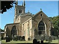
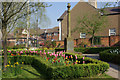
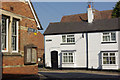
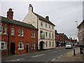
Photos of LE17 4EB

Area Information
Living in LE17 4EB means being part of a tightly knit residential cluster in England, where 2,158 residents occupy 875 square metres of space. The area’s population density of 1,003 people per square kilometre suggests a compact, community-focused environment. This postcode is defined by its small scale, offering a quiet, residential character distinct from larger urban centres. Daily life here is likely shaped by proximity to local amenities and a demographic skewed towards adults aged 30–64, with a median age of 47. The area’s housing stock is predominantly owner-occupied, with 59% of homes owned outright, reflecting a stable, long-term resident base. While the data does not specify local landmarks or cultural hubs, the presence of nearby retail outlets and a rail link to Rugby suggests a balance between convenience and seclusion. For those seeking a manageable, low-density living environment with access to essential services, LE17 4EB offers a focused, practical alternative to sprawling suburbs.
- Area Type
- Postcode
- Area Size
- 875 m²
- Population
- 2158
- Population Density
- 1003 people/km²
The property market in LE17 4EB is characterised by a high rate of home ownership (59%) and a predominance of houses, which suggests a focus on owner-occupied, family-friendly housing. Given the area’s small size and population density, the housing stock is limited, likely offering fewer options than larger towns or cities. This makes the market relatively tight, with buyers potentially needing to consider nearby areas for more choices. The presence of houses rather than flats or apartments indicates a preference for private, standalone properties, which may align with the area’s mature demographic. For buyers, this means a potential emphasis on stability and long-term value, though the limited scale of the area may require flexibility in location searches.
House Prices in LE17 4EB
Showing 2 properties
| Address | Type | Beds | Baths | Last Sale Price | Last Sale Date | |
|---|---|---|---|---|---|---|
| Doctors Office, Lutterworth Medical Centre, Gilmorton Road, Lutterworth, LE17 4EB | commercial | - | - | - | - | |
| The Wycliffe Medical Practice, Lutterworth Medical Centre, Gilmorton Road, Lutterworth, LE17 4EB | commercial | - | - | - | - |
Energy Efficiency in LE17 4EB
The lifestyle in LE17 4EB is shaped by its proximity to retail and transport hubs. Within practical reach, residents have access to five retail outlets, including notable stores such as Waitrose Lutterworth, Morrisons Lutterworth, and Spar. These shops provide a range of grocery and convenience options, supporting daily errands and local shopping. The nearby Rugby Railway Station adds to the area’s connectivity, enabling travel to urban centres for leisure, work, or socialising. While the data does not mention parks or leisure facilities, the presence of retail and rail links suggests a focus on practicality over expansive recreational spaces. The small-scale nature of the area means amenities are concentrated, requiring residents to plan trips carefully but offering a streamlined, efficient lifestyle.
Amenities
Schools
The nearest schools to LE17 4EB include Sherrier Church of England Primary School, which serves the local community. While the data lists this school twice, it is the only educational institution mentioned, indicating a primary-level focus for the area. Families with young children may rely on this school for early education, though the absence of secondary schools or additional educational facilities suggests that students may need to travel further for higher education. The single primary school available could be a limiting factor for larger families, but its presence ensures basic schooling is accessible. Without data on Ofsted ratings or additional schools, the educational landscape remains narrowly defined, with no indication of specialist provisions or private institutions.
| Rank | School | Type | Entry gender | Ages |
|---|
Explore more schools in this area
Go to Schools tabDemographics
The community in LE17 4EB is predominantly composed of adults aged 30–64, with a median age of 47. This suggests a mature population, likely with established careers and family structures. Home ownership is strong, at 59%, with houses being the primary accommodation type. The area’s predominant ethnic group is White, though no further breakdown of diversity is provided. The population density of 1,003 people per square kilometre indicates a moderately compact settlement, which may influence the pace of life and social interactions. While the data does not include deprivation metrics, the high home ownership rate and stable age profile imply a relatively secure economic environment. This demographic profile may appeal to those seeking a settled, low-turnover community with a focus on long-term residency.
Household Size
Accommodation Type
Tenure
Ethnic Group
Religion
Household Composition
Age
Household Deprivation
NS-SEC
Explore more demographic insights in this area
Go to Demographics tabPlanning
Planning Constraints
- Flood RiskPremium
- Ramsar Wetland SitesPremium
- Area of Outstanding Natural BeautyPremium
- Protected Nature ReservePremium
- Protected WoodlandPremium