Area Overview for LE17 4EH
Photos of LE17 4EH
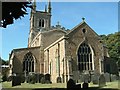

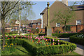
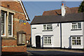
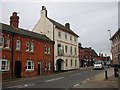
100 photos from this area
Area Information
Key information about the LE17 4EH including its size, population, and administrative classification.
- Area Type
- Postcode
- Area Size
- 5832 m²
- Population
- 2158
- Population Density
- 1003 people/km²
House Prices in LE17 4EH
28
Properties
£168,190
Average Sold Price
£76,000
Lowest Price
£280,000
Highest Price
Showing 28 properties
| Address | Type | Beds | Baths | Last Sale Price | Last Sale Date | |
|---|---|---|---|---|---|---|
| 26 Market Street, Lutterworth, LE17 4EH | Terraced | 3 | 1 | £147,000 | Sep 2025 | |
| 30 Market Street, Lutterworth, LE17 4EH | Terraced | 3 | 1 | £187,450 | Nov 2020 | |
| 20 Market Street, Lutterworth, LE17 4EH | Semi-detached | 3 | 1 | £193,500 | Mar 2020 | |
| 22 Market Street, Lutterworth, LE17 4EH | Semi-detached | 3 | 1 | £168,000 | Dec 2018 | |
| 38 Market Street, Lutterworth, LE17 4EH | Cottage | 3 | 1 | £239,950 | Aug 2017 | |
| 44 Market Street, Lutterworth, LE17 4EH | house | 4 | - | £280,000 | Nov 2016 | |
| 40 Market Street, Lutterworth, LE17 4EH | Semi-detached | 3 | 1 | £145,000 | Feb 2015 | |
| 46 Market Street, Lutterworth, LE17 4EH | Flat | 1 | 1 | £76,000 | May 2014 | |
| 32 Market Street, Lutterworth, LE17 4EH | house | 3 | 1 | £130,000 | Feb 2011 | |
| 18 Market Street, Lutterworth, LE17 4EH | Detached | - | - | £115,000 | Dec 2003 |
Page 1 of 3
Energy Efficiency in LE17 4EH
Amenities
Schools
| Rank | School | Type | Entry gender | Ages |
|---|
Explore more schools in this area
Go to Schools tabDemographics
Household Size
One person
most common
Accommodation Type
Houses
most common
Tenure
59
majority
Ethnic Group
White
most common
Religion
N/A
most common
Household Composition
N/A
most common
Age
47
median
Adults (30-64 years)
most common
Household Deprivation
N/A
with no deprivation
NS-SEC
35
in Lower managerial occupations
Explore more demographic insights in this area
Go to Demographics tabPlanning
Planning Constraints
- Flood RiskPremium
- Ramsar Wetland SitesPremium
- Area of Outstanding Natural BeautyPremium
- Protected Nature ReservePremium
- Protected WoodlandPremium