Area Overview for LE16 8DT
Photos of LE16 8DT


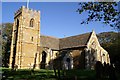


45 photos from this area
Area Information
Key information about the LE16 8DT including its size, population, and administrative classification.
- Area Type
- Postcode
- Area Size
- 6.5 hectares
- Population
- 2378
- Population Density
- 41 people/km²
House Prices in LE16 8DT
32
Properties
£532,583
Average Sold Price
£77,000
Lowest Price
£2,650,000
Highest Price
Showing 32 properties
| Address | Type | Beds | Baths | Last Sale Price | Last Sale Date | |
|---|---|---|---|---|---|---|
| 32 Main Street, Medbourne, LE16 8DT | Detached | 3 | 2 | £650,000 | Jun 2025 | |
| Meadow View, Main Street, Medbourne, LE16 8DT | house | - | - | £540,000 | Aug 2024 | |
| 46 Main Street, Medbourne, LE16 8DT | Terraced | 2 | 1 | £270,000 | Sep 2022 | |
| 14 Main Street, Medbourne, LE16 8DT | Terraced | 3 | 1 | £400,000 | Nov 2021 | |
| Pagets Farmhouse, 36 Main Street, Medbourne, LE16 8DT | Detached | - | - | £2,650,000 | Jul 2021 | |
| 24 Main Street, Medbourne, LE16 8DT | house | - | - | £455,000 | Dec 2020 | |
| Aspect House, 41A Main Street, Medbourne, LE16 8DT | Semi-detached | 4 | 1 | £385,000 | Nov 2017 | |
| Hinch's Barn, 38 Main Street, Medbourne, LE16 8DT | house | - | - | £915,000 | Nov 2016 | |
| 37 Main Street, Medbourne, LE16 8DT | Bungalow | 3 | 2 | £350,000 | Jan 2013 | |
| 3 Main Street, Medbourne, LE16 8DT | house | - | - | £307,000 | Nov 2012 |
Page 1 of 4
Energy Efficiency in LE16 8DT
Amenities
Schools
| Rank | School | Type | Entry gender | Ages |
|---|
Explore more schools in this area
Go to Schools tabDemographics
Household Size
Two person
most common
Accommodation Type
Houses
most common
Tenure
80
majority
Ethnic Group
White
most common
Religion
N/A
most common
Household Composition
N/A
most common
Age
47
median
Adults (30-64 years)
most common
Household Deprivation
N/A
with no deprivation
NS-SEC
46
in Lower managerial occupations
Explore more demographic insights in this area
Go to Demographics tabPlanning
Planning Constraints
- Flood RiskPremium
- Ramsar Wetland SitesPremium
- Area of Outstanding Natural BeautyPremium
- Protected Nature ReservePremium
- Protected WoodlandPremium