Area Overview for LE14 4QW
Photos of LE14 4QW
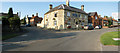
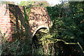
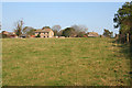
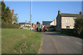
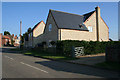
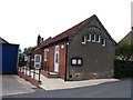
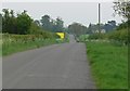
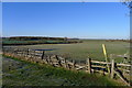
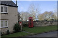
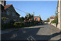
25 photos from this area
Area Information
Key information about the LE14 4QW including its size, population, and administrative classification.
- Area Type
- Postcode
- Area Size
- 23.6 hectares
- Population
- 1820
- Population Density
- 24 people/km²
House Prices in LE14 4QW
27
Properties
£340,231
Average Sold Price
£175,000
Lowest Price
£477,500
Highest Price
Showing 27 properties
| Address | Type | Beds | Baths | Last Sale Price | Last Sale Date | |
|---|---|---|---|---|---|---|
| 2 Main Street, Saltby, LE14 4QW | house | - | - | £275,000 | Feb 2024 | |
| Beech House, 22A Main Street, Saltby, LE14 4QW | house | - | - | £350,000 | Oct 2021 | |
| Mistletoe Cottage, 31 Main Street, Saltby, LE14 4QW | Semi-detached | 4 | 2 | £443,000 | Feb 2021 | |
| 11 Main Street, Saltby, LE14 4QW | house | - | - | £370,000 | Feb 2018 | |
| Old Post Office, 17 Main Street, Saltby, LE14 4QW | house | 2 | - | £465,000 | Dec 2017 | |
| 9 Main Street, Saltby, LE14 4QW | Detached | 3 | 1 | £249,500 | Mar 2012 | |
| 24 Main Street, Saltby, LE14 4QW | Detached | 4 | 2 | £352,000 | Oct 2010 | |
| The Butts, 24A Main Street, Saltby, LE14 4QW | Detached | - | - | £477,500 | Nov 2006 | |
| Rose Cottage, 10 Main Street, Saltby, LE14 4QW | Detached | - | - | £445,000 | Jun 2006 | |
| Pear Tree Cottage, 20 Main Street, Saltby, LE14 4QW | Semi-detached | - | - | £190,000 | Mar 2006 |
Page 1 of 3
Energy Efficiency in LE14 4QW
Amenities
Schools
| Rank | School | Type | Entry gender | Ages |
|---|
Explore more schools in this area
Go to Schools tabDemographics
Household Size
Two person
most common
Accommodation Type
Houses
most common
Tenure
65
majority
Ethnic Group
White
most common
Religion
N/A
most common
Household Composition
N/A
most common
Age
47
median
Adults (30-64 years)
most common
Household Deprivation
N/A
with no deprivation
NS-SEC
41
in Lower managerial occupations
Explore more demographic insights in this area
Go to Demographics tabPlanning
Planning Constraints
- Flood RiskPremium
- Ramsar Wetland SitesPremium
- Area of Outstanding Natural BeautyPremium
- Protected Nature ReservePremium
- Protected WoodlandPremium