Area Overview for LE14 4RJ
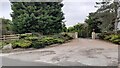
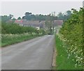
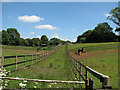
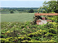
Photos of LE14 4RJ
Area Information
Living in LE14 4RJ means inhabiting a small, tightly knit residential cluster in England, where the population of 1820 spreads across 24 people per square kilometre. This is a quiet, low-density area, more akin to a village than a sprawling suburb. The community is defined by its mature demographic, with a median age of 47 and a majority of residents aged 30–64. Daily life here is likely to revolve around local routines, with homes predominantly owner-occupied (65%) and built as single-family houses. The area lacks the density of urban centres but offers a sense of seclusion. Proximity to Croxton Kerrial Church of England Primary School, which serves the community with a good Ofsted rating, suggests families are a key part of the local fabric. While there are no major transport hubs or commercial districts nearby, the area’s low crime risk and minimal environmental constraints make it appealing for those seeking a peaceful, stable environment. For buyers, LE14 4RJ represents a chance to own a home in a setting where community ties and quiet living are prioritised over fast-paced urban amenities.
- Area Type
- Postcode
- Area Size
- Not available
- Population
- 1820
- Population Density
- 24 people/km²
The property market in LE14 4RJ is characterised by a high rate of home ownership (65%) and a focus on single-family houses. This suggests the area is not a rental hotspot but rather a place where residents are likely to own their homes long-term. The predominance of houses over flats or apartments means the housing stock is suited to families or individuals seeking more space, though the small population size implies limited development. Buyers should expect a market where properties are likely to be older, given the median age of residents, and where demand is driven by local needs rather than commuter appeal. The absence of major planning constraints or environmental restrictions may make the area attractive for those seeking a stable, low-risk investment. However, the small size of the postcode means the immediate surroundings are critical—prospective buyers should consider nearby areas for additional options.
House Prices in LE14 4RJ
No properties found in this postcode.
Energy Efficiency in LE14 4RJ
The lifestyle in LE14 4RJ is shaped by its proximity to essential retail amenities, including Co-op Bridge and Asda Colsterworth. These stores offer basic shopping needs, though the area lacks larger supermarkets or specialist shops. Dining options are not specified in the data, but the presence of a primary school and low population density suggests a community-oriented approach to leisure. Parks or recreational spaces are not mentioned, which may limit opportunities for outdoor activities. The area’s character is defined by its quiet, low-density living, with daily life revolving around local routines. While the lack of extensive amenities may appeal to those seeking simplicity, it also means residents must travel further for more diverse options. The convenience of nearby retail and the safety of the area make it suitable for those prioritising stability over urban vibrancy.
Amenities
Schools
The nearest school to LE14 4RJ is Croxton Kerrial Church of England Primary School, a primary institution with an Ofsted rating of good. This single school serves the area’s children, though no secondary schools are listed in the data. The presence of a well-rated primary school is a key draw for families, ensuring access to quality early education. However, the absence of secondary schools or other educational institutions may require students to travel to nearby towns for further schooling. The school’s good rating indicates a commitment to standards, but buyers should verify whether the school’s capacity meets local demand, particularly as the area’s population is small. For those prioritising proximity to education, LE14 4RJ offers a solid foundation, though broader educational options may lie beyond the immediate vicinity.
| Rank | School | Type | Entry gender | Ages |
|---|
Explore more schools in this area
Go to Schools tabDemographics
The population of LE14 4RJ is 1820, with a median age of 47, indicating a mature demographic. Over half the residents fall within the 30–64 age range, suggesting a community skewed towards established adults rather than younger families or retirees. Home ownership is high at 65%, with houses being the predominant type of accommodation. This implies a stable, long-term resident base, with fewer rental properties or transient populations. The predominant ethnic group is White, though no further breakdown of diversity is provided. The low population density of 24 people per square kilometre reinforces the area’s rural or semi-rural character. While no data on deprivation is included, the high home ownership rate and low crime risk suggest a relatively affluent or stable community. However, the absence of younger demographics or diverse ethnic groups may mean the area lacks the dynamism of more cosmopolitan regions. For buyers, this profile indicates a market where property is likely to be held by long-term residents rather than speculative investors.
Household Size
Accommodation Type
Tenure
Ethnic Group
Religion
Household Composition
Age
Household Deprivation
NS-SEC
Explore more demographic insights in this area
Go to Demographics tabPlanning
Planning Constraints
- Flood RiskPremium
- Ramsar Wetland SitesPremium
- Area of Outstanding Natural BeautyPremium
- Protected Nature ReservePremium
- Protected WoodlandPremium