Area Overview for LE14 3RE
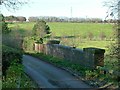
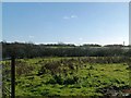
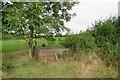
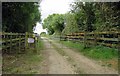
Photos of LE14 3RE


Area Information
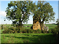
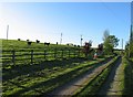
Living in LE14 3RE means being part of a small, tightly knit residential cluster in central England. The area covers 27.8 hectares and is home to 1,726 people, giving it a population density of 234 people per square kilometre. This is a low-density, house-dominated community, with the majority of residents owning their homes. The area’s compact size means amenities and services are within practical reach, though it remains a quiet, semi-rural setting. Daily life here is likely to revolve around local shops, nearby rail links, and a stable demographic profile. While it lacks the vibrancy of larger towns, LE14 3RE offers a peaceful environment with minimal planning constraints. Its proximity to Melton Mowbray and surrounding villages provides access to more extensive services without the congestion of urban centres. For those seeking a slower pace of life, this postcode area balances simplicity with practicality, though it may not appeal to those requiring high-density urban living.
- Area Type
- Postcode
- Area Size
- 27.8 hectares
- Population
- 1726
- Population Density
- 234 people/km²
The property market in LE14 3RE is characterised by a high rate of home ownership, with 67% of properties owned by residents rather than rented. This suggests a community of long-term residents, many of whom may have purchased their homes as family residences. The accommodation type is predominantly houses, which are more common than flats or apartments. This housing stock is likely to appeal to buyers seeking traditional, spacious properties in a semi-rural setting. However, the small area size and limited data on property types mean the market is unlikely to cater to high-demand urban segments like student housing or short-term rentals. For buyers, this means a focus on individual homes rather than investment opportunities in multi-unit properties. The area’s compact nature also means property values may be influenced more by local amenities than by proximity to major cities.
House Prices in LE14 3RE
No properties found in this postcode.
Energy Efficiency in LE14 3RE
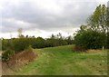
The lifestyle in LE14 3RE is shaped by its proximity to local retail and transport hubs. Nearby shops include Tesco Nottingham, Sainsburys Melton, and Co-op Ashfordby, providing essential services within reach. These stores cater to daily needs, from groceries to household items, reducing the necessity for long trips. The area’s rail link to Melton Mowbray adds convenience for those requiring access to larger towns or cities. While the data does not mention parks or leisure facilities, the low population density and lack of planning constraints suggest space for informal outdoor activities. The combination of local shopping and rail connectivity creates a balanced lifestyle, though the absence of detailed information on recreational amenities means the full extent of leisure options remains unclear.
Amenities
Schools
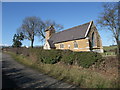
The nearest school to LE14 3RE is Asfordby Hill Primary School, which serves the local community. The data lists this school twice, but it is the only educational institution explicitly mentioned. As a primary school, it caters to younger children, though no information is provided on its Ofsted rating or academic performance. Families relying on this school would need to consider its capacity and whether it meets their child’s educational needs. The absence of secondary schools or other educational institutions in the data means families may need to travel to nearby towns for further schooling. This could be a consideration for those prioritising a full range of educational options within the area.
| Rank | School | Type | Entry gender | Ages |
|---|
Explore more schools in this area
Go to Schools tabDemographics
The community in LE14 3RE is predominantly middle-aged, with a median age of 47 and the most common age range being adults aged 30–64. This suggests a stable population with a focus on family homes and long-term residency. Home ownership is high, at 67%, indicating a strong presence of owner-occupied properties. The area is largely composed of houses, which aligns with the demographic profile of older, established residents. The predominant ethnic group is White, reflecting a homogenous community. While no specific data on deprivation is provided, the high home ownership rate and low population density suggest a relatively stable economic environment. However, the absence of detailed diversity metrics means the area’s social composition remains largely unexplored in the data.
Household Size
Accommodation Type
Tenure
Ethnic Group
Religion
Household Composition
Age
Household Deprivation
NS-SEC
Explore more demographic insights in this area
Go to Demographics tabPlanning
Planning Constraints
- Flood RiskPremium
- Ramsar Wetland SitesPremium
- Area of Outstanding Natural BeautyPremium
- Protected Nature ReservePremium
- Protected WoodlandPremium