Area Overview for LE14 3JP
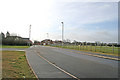
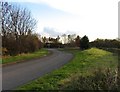
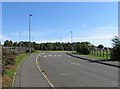
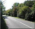
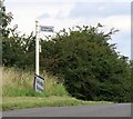
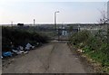
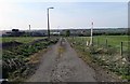
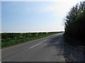
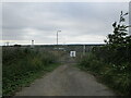
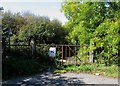
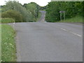
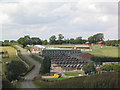
Photos of LE14 3JP
Area Information
Living in LE14 3JP means inhabiting a compact, low-density residential cluster in England’s East Midlands. The area spans 19.1 hectares and is home to 1,726 people, translating to a population density of 234 people per square kilometre. This small postcode area is characterised by its quiet, suburban charm, with homes predominantly in traditional styles. Daily life here is shaped by its proximity to nearby towns and the presence of essential services. The area’s modest size fosters a sense of community, though its isolation from major urban centres means residents rely on nearby towns for broader amenities. With no significant natural or protected sites nearby, the landscape is unremarkable but functional, prioritising residential comfort over scenic appeal. The area’s appeal lies in its simplicity: a place where families and older adults can live without the pressures of city life, supported by basic infrastructure and a stable demographic profile.
- Area Type
- Postcode
- Area Size
- 19.1 hectares
- Population
- 1726
- Population Density
- 234 people/km²
The property market in LE14 3JP is dominated by owner-occupied homes, with 67% of properties owned by residents rather than rented. The area’s accommodation type is primarily houses, which is typical of smaller, suburban postcode clusters. This suggests a market where properties are likely to be family homes rather than apartments or flats. The limited size of the area means the housing stock is finite, and buyers should consider the immediate surroundings for a broader range of options. The high home ownership rate indicates a community of long-term residents, which may influence the availability of properties for sale. For buyers, this means a focus on individual homes rather than rental opportunities, with potential for stable property values in a low-risk, low-density setting.
House Prices in LE14 3JP
Showing 1 properties
| Address | Type | Beds | Baths | Last Sale Price | Last Sale Date | |
|---|---|---|---|---|---|---|
| Countrywide Freight Group, Warehouse And Storage Depot, St Bartholomews Way, Melton Mowbray, LE14 3JP | shop | - | - | - | - |
Energy Efficiency in LE14 3JP
The lifestyle in LE14 3JP is shaped by its proximity to retail and transport hubs. Nearby supermarkets include Tesco Nottingham, Sainsburys Melton, and Lidl North Melton, providing essential shopping options within practical reach. The Melton Mowbray Railway Station offers access to broader regional networks, facilitating commuting or travel. Beyond retail, the area lacks specific details on parks or leisure facilities, but its small size and suburban character suggest a focus on residential convenience rather than large-scale recreation. The presence of retail outlets and rail connectivity ensures daily life is functional, though residents may need to venture further for cultural or leisure opportunities.
Amenities
Schools
The nearest school to LE14 3JP is Asfordby Hill Primary School, which serves the local primary education needs of the area. No secondary schools are listed in the data, so families may need to look to nearby towns for secondary education. The presence of a primary school suggests that the area is suitable for young families, though the lack of higher-level schooling nearby could be a consideration for those requiring a full range of educational options. Asfordby Hill Primary School’s role as the sole listed school indicates that it is the primary educational hub for the community, though its Ofsted rating is not specified in the data.
| Rank | School | Type | Entry gender | Ages |
|---|
Explore more schools in this area
Go to Schools tabDemographics
The community in LE14 3JP is predominantly composed of adults aged 30–64, with a median age of 47. This suggests a mature, settled population, likely with established careers and families. Home ownership is high at 67%, indicating a strong presence of long-term residents rather than transient renters. The accommodation type is largely houses, which aligns with the area’s low-density layout and suburban character. The predominant ethnic group is White, reflecting the broader demographic trends of the region. There is no specific data on deprivation levels, but the high home ownership and stable age profile suggest a relatively secure economic environment. This demographic makeup supports a quiet, stable community where most residents are likely to have built their lives over many years.
Household Size
Accommodation Type
Tenure
Ethnic Group
Religion
Household Composition
Age
Household Deprivation
NS-SEC
Explore more demographic insights in this area
Go to Demographics tabPlanning
Planning Constraints
- Flood RiskPremium
- Ramsar Wetland SitesPremium
- Area of Outstanding Natural BeautyPremium
- Protected Nature ReservePremium
- Protected WoodlandPremium