Area Overview for LE12 9SN
Photos of LE12 9SN
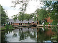
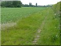
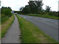
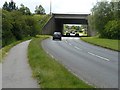
45 photos from this area
Area Information
Key information about the LE12 9SN including its size, population, and administrative classification.
- Area Type
- Postcode
- Area Size
- 2.0 hectares
- Population
- 1428
- Population Density
- 1373 people/km²
House Prices in LE12 9SN
43
Properties
£138,919
Average Sold Price
£34,000
Lowest Price
£265,000
Highest Price
Showing 43 properties
| Address | Type | Beds | Baths | Last Sale Price | Last Sale Date | |
|---|---|---|---|---|---|---|
| 48 Nursery Close, Shepshed, LE12 9SN | house | - | - | £120,000 | Apr 2024 | |
| 10 Nursery Close, Shepshed, LE12 9SN | Terraced | 2 | 1 | £142,500 | Dec 2023 | |
| 42 Nursery Close, Shepshed, LE12 9SN | Bungalow | 2 | - | £187,500 | Sep 2022 | |
| 40 Nursery Close, Shepshed, LE12 9SN | Retail | 2 | 1 | £182,500 | Sep 2022 | |
| 29 Nursery Close, Shepshed, LE12 9SN | house | - | - | £245,000 | Dec 2021 | |
| 14 Nursery Close, Shepshed, LE12 9SN | Terraced | 2 | - | £135,000 | Sep 2021 | |
| 4 Nursery Close, Shepshed, LE12 9SN | Semi-detached | 3 | 1 | £194,000 | May 2021 | |
| 19 Nursery Close, Shepshed, LE12 9SN | house | - | - | £180,000 | Mar 2021 | |
| 8 Nursery Close, Shepshed, LE12 9SN | house | - | - | £156,000 | Mar 2021 | |
| 27 Nursery Close, Shepshed, LE12 9SN | house | - | - | £265,000 | Mar 2021 |
Page 1 of 5
Energy Efficiency in LE12 9SN
Amenities
Schools
| Rank | School | Type | Entry gender | Ages |
|---|
Explore more schools in this area
Go to Schools tabDemographics
Household Size
Two person
most common
Accommodation Type
Houses
most common
Tenure
84
majority
Ethnic Group
White
most common
Religion
N/A
most common
Household Composition
N/A
most common
Age
47
median
Adults (30-64 years)
most common
Household Deprivation
N/A
with no deprivation
NS-SEC
32
in Lower managerial occupations
Explore more demographic insights in this area
Go to Demographics tabPlanning
Planning Constraints
- Flood RiskPremium
- Ramsar Wetland SitesPremium
- Area of Outstanding Natural BeautyPremium
- Protected Nature ReservePremium
- Protected WoodlandPremium