Area Overview for LE12 9GX
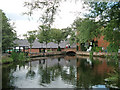
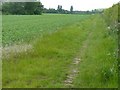
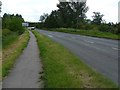
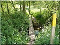
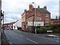
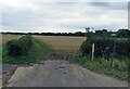
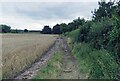
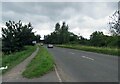
Photos of LE12 9GX


Area Information
Living in LE12 9GX means being part of a tightly knit residential cluster in England’s Midlands. This small area, spanning just 1.2 hectares, is home to 1,428 people, creating a densely populated yet compact community. The postcode covers a mix of housing stock, with 84% of homes owned by residents, reflecting a stable, long-term demographic. The area’s population density of 1,373 people per square kilometre suggests a mature, established neighbourhood where most residents are adults aged 30–64. Daily life here is shaped by proximity to retail, transport, and low environmental risk. With nearby supermarkets like Co-op Shepshed and Asda Shepshed, and easy access to Loughborough Railway Station, LE12 9GX balances convenience with a quiet, residential feel. The area’s safety profile, with a crime risk score of 80 (low) and minimal flood risk, adds to its appeal for those seeking a secure, manageable environment. While small, the postcode’s connectivity to major infrastructure, including East Midlands Airport and rail networks, ensures it is not isolated. This blend of practicality and safety makes LE12 9GX a compelling choice for buyers prioritising stability and accessibility.
- Area Type
- Postcode
- Area Size
- 1.2 hectares
- Population
- 1428
- Population Density
- 1373 people/km²
The property market in LE12 9GX is characterised by high home ownership (84%) and a focus on houses rather than flats or apartments. This suggests a community where long-term residency is the norm, with limited rental activity. The small area size (1.2 hectares) means the housing stock is tightly concentrated, offering buyers a limited but cohesive selection of properties. The absence of planning constraints, such as protected woodlands or AONB designations, ensures that development is not restricted, though the area’s size may limit expansion. For buyers, this means a market where properties are likely to be well-maintained and in stable demand. The predominance of houses, combined with the area’s safety and connectivity, positions LE12 9GX as a practical choice for those seeking a secure, family-friendly environment. However, the small footprint means competition for available homes may be fierce, particularly for those prioritising proximity to amenities like Loughborough Railway Station or nearby retail hubs.
House Prices in LE12 9GX
No properties found in this postcode.
Energy Efficiency in LE12 9GX
Residents of LE12 9GX have access to a range of amenities within walking or short driving distance. The area is served by three major supermarkets—Co-op Shepshed, Asda Shepshed, and Tesco Shepshed—ensuring everyday shopping needs are easily met. For transport, Loughborough Railway Station and East Midlands Parkway offer regular services, while the Quorn & Woodhouse Metro stop provides links to Loughborough Central. Though the area itself is small, its proximity to these hubs means residents can access broader retail, dining, and leisure options in nearby towns. The absence of large-scale leisure facilities within the postcode itself is balanced by its connectivity to surrounding areas. This blend of local convenience and regional accessibility creates a lifestyle that is practical for daily living, with minimal need to travel far for essential services. The compact nature of the area also fosters a sense of community, where familiarity with local shops and transport routes becomes second nature.
Amenities
Schools
| Rank | School | Type | Entry gender | Ages |
|---|
Explore more schools in this area
Go to Schools tabDemographics
The community in LE12 9GX is predominantly composed of adults aged 30–64, with a median age of 47. This suggests a mature population, likely with established careers and families. Home ownership is high at 84%, indicating a strong preference for long-term residency over rental properties. The area’s accommodation is almost entirely houses, which aligns with the demographic profile of older, settled residents. The predominant ethnic group is White, reflecting a homogenous population. The population density of 1,373 people per square kilometre, while high, is consistent with a compact, residential cluster. This density does not necessarily imply deprivation but highlights the area’s efficient use of space. For quality of life, the high home ownership rate and low crime risk (80/100) suggest a stable environment where residents can invest in property and feel secure. The absence of protected natural areas or planning constraints further simplifies living here, with no restrictions on development or land use.
Household Size
Accommodation Type
Tenure
Ethnic Group
Religion
Household Composition
Age
Household Deprivation
NS-SEC
Explore more demographic insights in this area
Go to Demographics tabPlanning
Planning Constraints
- Flood RiskPremium
- Ramsar Wetland SitesPremium
- Area of Outstanding Natural BeautyPremium
- Protected Nature ReservePremium
- Protected WoodlandPremium