Area Overview for LE12 8HY
Photos of LE12 8HY
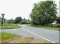
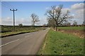
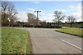
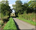
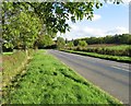
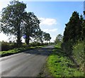
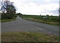
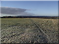
32 photos from this area
Area Information
Key information about the LE12 8HY including its size, population, and administrative classification.
- Area Type
- Postcode
- Area Size
- 39.7 hectares
- Population
- 1358
- Population Density
- 64 people/km²
House Prices in LE12 8HY
14
Properties
£490,933
Average Sold Price
£100,000
Lowest Price
£965,000
Highest Price
Showing 14 properties
| Address | Type | Beds | Baths | Last Sale Price | Last Sale Date | |
|---|---|---|---|---|---|---|
| 6 New Lane, Walton On The Wolds, LE12 8HY | Bungalow | 3 | 1 | £370,000 | Mar 2025 | |
| 22 New Lane, Walton On The Wolds, LE12 8HY | Detached | 5 | 3 | £760,000 | Dec 2014 | |
| 20 New Lane, Walton On The Wolds, LE12 8HY | Detached | - | - | £620,000 | Nov 2013 | |
| The Manor House, 9 New Lane, Walton On The Wolds, LE12 8HY | Detached | - | - | £965,000 | Jun 2008 | |
| 4 New Lane, Walton On The Wolds, LE12 8HY | Detached | - | - | £130,600 | Dec 2001 | |
| 14 New Lane, Walton On The Wolds, LE12 8HY | Semi-detached | - | - | £100,000 | Mar 2001 | |
| Granary Cottage, 12A New Lane, Walton On The Wolds, LE12 8HY | house | 4 | 3 | - | - | |
| 16 New Lane, Walton On The Wolds, LE12 8HY | house | 2 | 2 | - | - | |
| Marlborough House, 18 New Lane, Walton On The Wolds, LE12 8HY | Detached | 5 | 3 | - | - | |
| Rookery Farmhouse, 12 New Lane, Walton On The Wolds, LE12 8HY | house | - | - | - | - |
Page 1 of 2
Energy Efficiency in LE12 8HY
Amenities
Schools
| Rank | School | Type | Entry gender | Ages |
|---|
Explore more schools in this area
Go to Schools tabDemographics
Household Size
Two person
most common
Accommodation Type
Houses
most common
Tenure
86
majority
Ethnic Group
White
most common
Religion
N/A
most common
Household Composition
N/A
most common
Age
47
median
Adults (30-64 years)
most common
Household Deprivation
N/A
with no deprivation
NS-SEC
49
in Lower managerial occupations
Explore more demographic insights in this area
Go to Demographics tabPlanning
Planning Constraints
- Flood RiskPremium
- Ramsar Wetland SitesPremium
- Area of Outstanding Natural BeautyPremium
- Protected Nature ReservePremium
- Protected WoodlandPremium