Area Overview for LE12 7NN
Photos of LE12 7NN
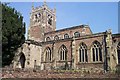
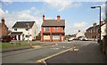
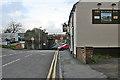
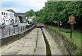
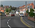
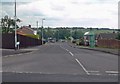
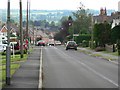
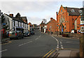
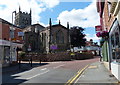
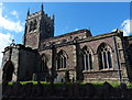
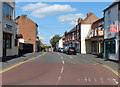
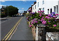
62 photos from this area
Area Information
Key information about the LE12 7NN including its size, population, and administrative classification.
- Area Type
- Postcode
- Area Size
- 3.0 hectares
- Population
- 2159
- Population Density
- 2038 people/km²
House Prices in LE12 7NN
79
Properties
£118,055
Average Sold Price
£18,000
Lowest Price
£245,000
Highest Price
Showing 79 properties
| Address | Type | Beds | Baths | Last Sale Price | Last Sale Date | |
|---|---|---|---|---|---|---|
| 49 Swan Street, Sileby, LE12 7NN | house | - | - | £138,000 | Sep 2025 | |
| 107 Swan Street, Sileby, LE12 7NN | Detached | 3 | 1 | £245,000 | Apr 2025 | |
| 5 Swan Street, Sileby, LE12 7NN | Terraced | 2 | 1 | £141,400 | Jun 2024 | |
| 15 Swan Street, Sileby, LE12 7NN | house | - | - | £90,000 | May 2024 | |
| 27 Swan Street, Sileby, LE12 7NN | Terraced | 2 | 1 | £150,000 | May 2024 | |
| 19 Swan Street, Sileby, LE12 7NN | Terraced | 2 | 1 | £135,000 | Nov 2023 | |
| 59 Swan Street, Sileby, LE12 7NN | Terraced | 2 | 1 | £176,000 | May 2022 | |
| 55 Swan Street, Sileby, LE12 7NN | Terraced | 2 | 1 | £189,000 | Dec 2021 | |
| 71 Swan Street, Sileby, LE12 7NN | Terraced | 2 | 1 | £155,000 | May 2021 | |
| 53 Swan Street, Sileby, LE12 7NN | Terraced | 2 | - | £162,500 | Nov 2020 |
Page 1 of 8
Energy Efficiency in LE12 7NN
Amenities
Schools
| Rank | School | Type | Entry gender | Ages |
|---|
Explore more schools in this area
Go to Schools tabDemographics
Household Size
Family (3-5 people)
most common
Accommodation Type
Houses
most common
Tenure
69
majority
Ethnic Group
White
most common
Religion
N/A
most common
Household Composition
N/A
most common
Age
47
median
Adults (30-64 years)
most common
Household Deprivation
N/A
with no deprivation
NS-SEC
32
in Lower managerial occupations
Explore more demographic insights in this area
Go to Demographics tabPlanning
Planning Constraints
- Flood RiskPremium
- Ramsar Wetland SitesPremium
- Area of Outstanding Natural BeautyPremium
- Protected Nature ReservePremium
- Protected WoodlandPremium