Area Overview for LE12 7RE
Photos of LE12 7RE
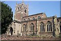
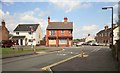
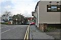
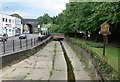
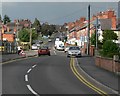
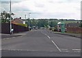
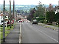
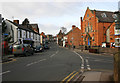
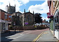
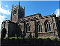
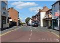
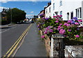
62 photos from this area
Area Information
Key information about the LE12 7RE including its size, population, and administrative classification.
- Area Type
- Postcode
- Area Size
- 1.2 hectares
- Population
- 2159
- Population Density
- 2038 people/km²
House Prices in LE12 7RE
40
Properties
£147,353
Average Sold Price
£25,000
Lowest Price
£240,000
Highest Price
Showing 40 properties
| Address | Type | Beds | Baths | Last Sale Price | Last Sale Date | |
|---|---|---|---|---|---|---|
| 4 The Banks, Sileby, LE12 7RE | Terraced | 1 | 1 | £155,000 | Jan 2025 | |
| 74 The Banks, Sileby, LE12 7RE | Terraced | 2 | 1 | £190,000 | May 2022 | |
| 90 The Banks, Sileby, LE12 7RE | house | - | - | £220,000 | Jan 2022 | |
| 42 The Banks, Sileby, LE12 7RE | Cottage | 3 | 1 | £240,000 | Nov 2021 | |
| 92 The Banks, Sileby, LE12 7RE | house | - | - | £197,000 | May 2021 | |
| 70 The Banks, Sileby, LE12 7RE | Semi-detached | 2 | 1 | £165,000 | Apr 2019 | |
| 96 The Banks, Sileby, LE12 7RE | Semi-detached | 3 | - | £151,000 | Mar 2018 | |
| 30 The Banks, Sileby, LE12 7RE | Terraced | 2 | 1 | £142,000 | Jan 2018 | |
| 98 The Banks, Sileby, LE12 7RE | Detached | 2 | 1 | £200,000 | Oct 2017 | |
| 52 The Banks, Sileby, LE12 7RE | Terraced | 2 | 1 | £130,000 | Jul 2017 |
Page 1 of 4
Energy Efficiency in LE12 7RE
Amenities
Schools
| Rank | School | Type | Entry gender | Ages |
|---|
Explore more schools in this area
Go to Schools tabDemographics
Household Size
Family (3-5 people)
most common
Accommodation Type
Houses
most common
Tenure
69
majority
Ethnic Group
White
most common
Religion
N/A
most common
Household Composition
N/A
most common
Age
47
median
Adults (30-64 years)
most common
Household Deprivation
N/A
with no deprivation
NS-SEC
32
in Lower managerial occupations
Explore more demographic insights in this area
Go to Demographics tabPlanning
Planning Constraints
- Flood RiskPremium
- Ramsar Wetland SitesPremium
- Area of Outstanding Natural BeautyPremium
- Protected Nature ReservePremium
- Protected WoodlandPremium