Area Overview for LE11 3JA
Photos of LE11 3JA


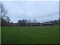
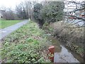
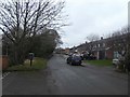

37 photos from this area
Area Information
Key information about the LE11 3JA including its size, population, and administrative classification.
- Area Type
- Postcode
- Area Size
- 2.8 hectares
- Population
- 1491
- Population Density
- 2948 people/km²
House Prices in LE11 3JA
54
Properties
£197,918
Average Sold Price
£47,000
Lowest Price
£398,000
Highest Price
Showing 54 properties
| Address | Type | Beds | Baths | Last Sale Price | Last Sale Date | |
|---|---|---|---|---|---|---|
| 84 Holt Drive, Loughborough, LE11 3JA | Detached | 4 | 2 | £386,000 | Dec 2025 | |
| 100 Holt Drive, Loughborough, LE11 3JA | Semi-detached | 3 | 1 | £398,000 | Aug 2025 | |
| 30 Holt Drive, Loughborough, LE11 3JA | Semi-detached | 3 | 1 | £245,000 | Aug 2024 | |
| 62 Holt Drive, Loughborough, LE11 3JA | house | - | - | £322,500 | Jun 2024 | |
| 32 Holt Drive, Loughborough, LE11 3JA | Semi-detached | 3 | 1 | £279,800 | May 2024 | |
| 50 Holt Drive, Loughborough, LE11 3JA | house | 3 | 1 | £285,000 | Oct 2023 | |
| 52 Holt Drive, Loughborough, LE11 3JA | Semi-detached | 3 | 2 | £308,000 | Aug 2022 | |
| 58 Holt Drive, Loughborough, LE11 3JA | house | - | - | £240,000 | May 2021 | |
| 38 Holt Drive, Loughborough, LE11 3JA | Semi-detached | 3 | 1 | £245,000 | Mar 2020 | |
| 40 Holt Drive, Loughborough, LE11 3JA | Detached | 3 | 1 | £223,000 | Oct 2019 |
Page 1 of 6
Energy Efficiency in LE11 3JA
Amenities
Schools
| Rank | School | Type | Entry gender | Ages |
|---|
Explore more schools in this area
Go to Schools tabDemographics
Household Size
Two person
most common
Accommodation Type
Houses
most common
Tenure
85
majority
Ethnic Group
White
most common
Religion
N/A
most common
Household Composition
N/A
most common
Age
47
median
Adults (30-64 years)
most common
Household Deprivation
N/A
with no deprivation
NS-SEC
35
in Lower managerial occupations
Explore more demographic insights in this area
Go to Demographics tabPlanning
Planning Constraints
- Flood RiskPremium
- Ramsar Wetland SitesPremium
- Area of Outstanding Natural BeautyPremium
- Protected Nature ReservePremium
- Protected WoodlandPremium