Area Overview for LE11 2XE
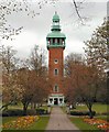
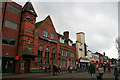
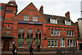
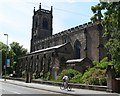
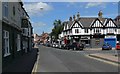
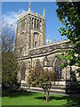
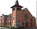
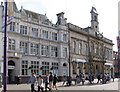
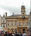
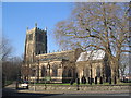
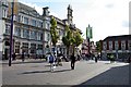
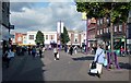
Photos of LE11 2XE
Area Information
Living in LE11 2XE means inhabiting a compact, densely populated postcode area in England’s East Midlands. With a population of 1,459 spread across just 1,001 square metres, this small cluster of homes is highly concentrated. The area’s proximity to Loughborough and its surrounding towns makes it a practical base for commuters and students. Daily life here is shaped by its proximity to independent schools, retail hubs, and transport links. The demographic profile suggests a young, transient community, with the median age at 22 and most residents aged between 15 and 29. This reflects a mix of students, young professionals, and families seeking affordable housing. The area’s flat-dominated housing stock and high population density indicate a focus on shared living and rental properties, though only 31% of homes are owner-occupied. For those considering LE11 2XE, the key appeal lies in its accessibility to nearby amenities and educational institutions, balanced against its compact, sometimes crowded footprint.
- Area Type
- Postcode
- Area Size
- 1001 m²
- Population
- 1459
- Population Density
- 2925 people/km²
The property market in LE11 2XE is characterised by a high proportion of rental properties and a focus on flats. With only 31% of homes owner-occupied, the area functions more as a rental market than a place for long-term homeownership. The dominance of flats reflects both the high population density and the need for compact, affordable housing. This makes the area particularly attractive to young professionals, students, and those seeking short-term accommodation. However, the limited home ownership rate also means competition for available properties, especially in a small postcode area. Buyers considering LE11 2XE should expect a market where flats are the norm, with fewer opportunities for larger family homes. The proximity to Loughborough’s amenities and transport links may offset the lack of spacious properties, but the compact nature of the area means buyers must prioritise location over size.
House Prices in LE11 2XE
No properties found in this postcode.
Energy Efficiency in LE11 2XE
Residents of LE11 2XE benefit from a range of nearby amenities, including retail outlets like Tesco Leicester, Iceland Loughborough, and M&S Loughborough SF. These shops cater to everyday needs, from groceries to clothing. The area’s proximity to Loughborough’s town centre and surrounding villages ensures access to dining, leisure, and cultural activities. While specific parks or recreational spaces are not listed, the presence of multiple retail and transport hubs suggests a convenient, active lifestyle. The mix of independent schools, retail, and transport options creates a practical environment for young professionals and families. However, the lack of detailed information on parks or leisure facilities means residents may need to look further afield for outdoor recreation. Overall, the area’s amenities support a functional, urbanised lifestyle with minimal need for long commutes.
Amenities
Schools
Residents of LE11 2XE have access to a range of independent schools within practical reach. These include Loughborough Amherst School, Loughborough Grammar School, Loughborough High School, Fairfield Prep School, and Ellerslie School. All are independent institutions, though specific Ofsted ratings are not provided. The presence of multiple independent schools suggests a focus on private education, which may appeal to families prioritising academic or specialist curricula. However, the absence of state schools in the data means the area’s educational options are limited to private institutions. For families seeking state education, proximity to nearby towns like Loughborough may be necessary. The concentration of independent schools reflects the area’s demographic profile, with young professionals and students likely to value the quality of private education.
| Rank | School | Type | Entry gender | Ages |
|---|
Explore more schools in this area
Go to Schools tabDemographics
The community in LE11 2XE is predominantly young, with a median age of 22 and the majority of residents falling into the 15–29 age bracket. This suggests a population skewed towards students, recent graduates, and young professionals. Home ownership is relatively low, with only 31% of residents owning their homes, indicating a rental-heavy market. The accommodation type is almost entirely flats, reflecting the area’s high population density of 1,458,074 people per square kilometre. This density, combined with the flat-dominated housing stock, points to a community prioritising affordability and shared living spaces over larger family homes. The predominant ethnic group is White, though specific data on diversity or deprivation is not provided. The age profile and housing patterns suggest a dynamic, transient population, with limited long-term residency. For prospective buyers, this means a market more suited to short-term stays or investment in rental properties than family-oriented homeownership.
Household Size
Accommodation Type
Tenure
Ethnic Group
Religion
Household Composition
Age
Household Deprivation
NS-SEC
Explore more demographic insights in this area
Go to Demographics tabPlanning
Planning Constraints
- Flood RiskPremium
- Ramsar Wetland SitesPremium
- Area of Outstanding Natural BeautyPremium
- Protected Nature ReservePremium
- Protected WoodlandPremium