Area Overview for LE11 2QL
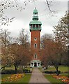
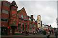
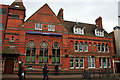
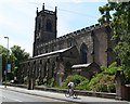
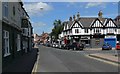
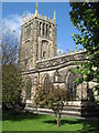
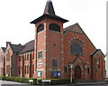
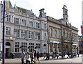
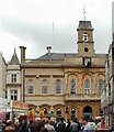
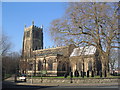
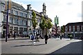
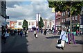
Photos of LE11 2QL
Area Information
LE11 2QL is a compact postcode area in England, covering just 1580 square metres and home to 1459 residents. Its high population density—nearly 924,000 people per square kilometre—reflects a tightly knit, urbanised cluster. The area’s character is shaped by its demographic profile: a young population, with the median age at 22 and the majority aged 15–29. This suggests a community centred around students, young professionals, or those in early careers. The accommodation here is predominantly flats, with only 31% of homes owner-occupied, pointing to a rental market that may cater to transient or budget-conscious residents. Despite its small size, the area is strategically located near key amenities, including independent schools and transport links. However, its high crime risk score—1 out of 100—means residents must be mindful of security. For those seeking a dynamic, youthful environment with proximity to services, LE11 2QL offers a mix of convenience and challenge.
- Area Type
- Postcode
- Area Size
- 1580 m²
- Population
- 1459
- Population Density
- 2925 people/km²
The property market in LE11 2QL is characterised by a low home ownership rate—just 31% of residents own their homes. This suggests a rental-dominated market, with flats being the primary accommodation type. Given the area’s small size and high density, the housing stock is limited, which may make it challenging for buyers seeking long-term investment. The prevalence of flats could indicate a focus on affordability, possibly catering to students or young professionals. However, the high crime risk score—1 out of 100—may deter some buyers, despite the area’s proximity to amenities. For those considering the area, the small size means the immediate surroundings are critical. Nearby towns like Loughborough offer broader housing options, but within LE11 2QL itself, properties are likely to be smaller and more transient. Buyers should weigh the convenience of nearby services against the area’s security concerns.
House Prices in LE11 2QL
Showing 1 properties
| Address | Type | Beds | Baths | Last Sale Price | Last Sale Date | |
|---|---|---|---|---|---|---|
| Former Managers Accommodation, Ramada Loughborough, High Street, Loughborough, LE11 2QL | Flat | - | - | - | - |
Energy Efficiency in LE11 2QL
Residents of LE11 2QL have access to a range of amenities within easy reach. Retail options include major stores like Tesco Leicester, Iceland Loughborough, and M&S Loughborough SF, catering to everyday shopping needs. The area’s metro and rail stations—Loughborough Central, Quorn & Woodhouse, and Rothley—provide convenient transport links to surrounding towns. While there is no mention of parks or leisure facilities in the data, the presence of multiple retail and transport hubs suggests a lifestyle focused on convenience and connectivity. The compact nature of the area means residents can access services without long commutes, though the lack of green spaces or recreational facilities may be a drawback for some. For those prioritising accessibility over space, LE11 2QL offers a practical, service-rich environment.
Amenities
Schools
Residents of LE11 2QL have access to several independent schools, including Loughborough Amherst School, Loughborough Grammar School, Loughborough High School, Fairfield Prep School, and Ellerslie School. These institutions are all private, offering a range of educational options for families. The concentration of independent schools suggests a community where private education is a priority, though no Ofsted ratings are provided to assess their performance. The presence of multiple schools in one area may indicate a demand for high-quality, specialist education, often associated with fee-paying institutions. For families seeking private schooling, this cluster of schools could be a significant draw. However, the lack of state school options means parents must consider the financial implications of private education. The mix of school types reflects the area’s demographic focus on young, possibly higher-income households.
| Rank | School | Type | Entry gender | Ages |
|---|
Explore more schools in this area
Go to Schools tabDemographics
The population of LE11 2QL is overwhelmingly young, with 22 as the median age and 15–29-year-olds making up the largest age group. This demographic skew suggests a community focused on education, employment, or transitional living. Only 31% of residents own their homes, with flats being the dominant housing type. This low home ownership rate indicates a rental market that may reflect the area’s appeal to students or those requiring flexible housing. The predominant ethnic group is White, though specific data on diversity or deprivation is not provided. The high proportion of young adults may influence local culture, with social hubs or shared spaces being more prevalent. However, the lack of data on income levels or deprivation means the area’s economic challenges remain unquantified. For buyers, this profile suggests a market driven by affordability and proximity to services, rather than long-term investment.
Household Size
Accommodation Type
Tenure
Ethnic Group
Religion
Household Composition
Age
Household Deprivation
NS-SEC
Explore more demographic insights in this area
Go to Demographics tabPlanning
Planning Constraints
- Flood RiskPremium
- Ramsar Wetland SitesPremium
- Area of Outstanding Natural BeautyPremium
- Protected Nature ReservePremium
- Protected WoodlandPremium