Area Overview for LE11 2HH
Photos of LE11 2HH
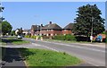
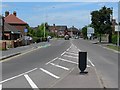
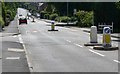
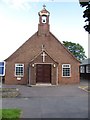
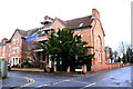
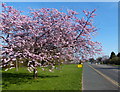
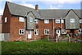
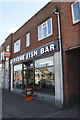
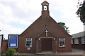
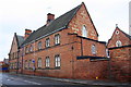
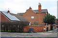
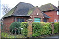
46 photos from this area
Area Information
Key information about the LE11 2HH including its size, population, and administrative classification.
- Area Type
- Postcode
- Area Size
- 4.4 hectares
- Population
- 1569
- Population Density
- 4505 people/km²
House Prices in LE11 2HH
45
Properties
£267,131
Average Sold Price
£160,000
Lowest Price
£500,000
Highest Price
Showing 45 properties
| Address | Type | Beds | Baths | Last Sale Price | Last Sale Date | |
|---|---|---|---|---|---|---|
| 142 Park Road, Loughborough, LE11 2HH | Semi-detached | 3 | 1 | £255,000 | Jan 2025 | |
| 104 Park Road, Loughborough, LE11 2HH | house | 4 | 2 | £365,000 | May 2023 | |
| 78 Park Road, Loughborough, LE11 2HH | Semi-detached | 3 | 1 | £450,000 | May 2023 | |
| 146 Park Road, Loughborough, LE11 2HH | Semi-detached | 3 | 2 | £260,000 | May 2023 | |
| 150 Park Road, Loughborough, LE11 2HH | Flat | 1 | 1 | £225,000 | May 2022 | |
| 88 Park Road, Loughborough, LE11 2HH | house | - | - | £500,000 | Nov 2021 | |
| 110 Park Road, Loughborough, LE11 2HH | house | - | - | £275,000 | Jul 2021 | |
| 124 Park Road, Loughborough, LE11 2HH | house | 4 | 2 | £296,000 | Apr 2021 | |
| 82 Park Road, Loughborough, LE11 2HH | Detached | 4 | 2 | £400,000 | Jan 2021 | |
| 108 Park Road, Loughborough, LE11 2HH | house | - | - | £373,000 | Oct 2020 |
Page 1 of 5
Energy Efficiency in LE11 2HH
Amenities
Schools
| Rank | School | Type | Entry gender | Ages |
|---|
Explore more schools in this area
Go to Schools tabDemographics
Household Size
Family (3-5 people)
most common
Accommodation Type
Houses
most common
Tenure
73
majority
Ethnic Group
White
most common
Religion
N/A
most common
Household Composition
N/A
most common
Age
47
median
Adults (30-64 years)
most common
Household Deprivation
N/A
with no deprivation
NS-SEC
41
in Lower managerial occupations
Explore more demographic insights in this area
Go to Demographics tabPlanning
Planning Constraints
- Flood RiskPremium
- Ramsar Wetland SitesPremium
- Area of Outstanding Natural BeautyPremium
- Protected Nature ReservePremium
- Protected WoodlandPremium