Area Overview for LE11 2ED
Photos of LE11 2ED
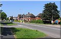
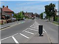
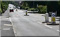
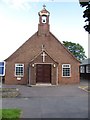
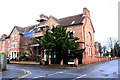
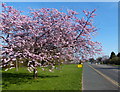
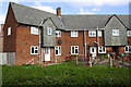
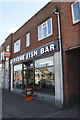

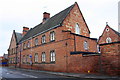
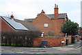
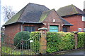
46 photos from this area
Area Information
Key information about the LE11 2ED including its size, population, and administrative classification.
- Area Type
- Postcode
- Area Size
- 8929 m²
- Population
- 1459
- Population Density
- 2925 people/km²
House Prices in LE11 2ED
47
Properties
£341,338
Average Sold Price
£90,000
Lowest Price
£675,000
Highest Price
Showing 47 properties
| Address | Type | Beds | Baths | Last Sale Price | Last Sale Date | |
|---|---|---|---|---|---|---|
| 43 Park Road, Loughborough, LE11 2ED | house | 6 | 3 | £450,000 | Mar 2024 | |
| 5 Park Road, Loughborough, LE11 2ED | Flat | - | - | £90,000 | Feb 2024 | |
| 37 Park Road, Loughborough, LE11 2ED | house | - | - | £228,000 | Jan 2024 | |
| 41 Park Road, Loughborough, LE11 2ED | Terraced | 5 | 2 | £280,000 | Oct 2023 | |
| 11A Park Road, Loughborough, LE11 2ED | house | - | - | £205,000 | Apr 2023 | |
| 35 Park Road, Loughborough, LE11 2ED | house | 5 | - | £399,950 | Aug 2022 | |
| 45 PARK ROAD, Loughborough, LE11 2ED | Unknown | - | - | £675,000 | Jun 2022 | |
| 15 Park Road, Loughborough, LE11 2ED | house | - | - | £350,000 | Apr 2022 | |
| 29 Park Road, Loughborough, LE11 2ED | Terraced | - | - | £325,000 | Apr 2020 | |
| 33 Park Road, Loughborough, LE11 2ED | Detached | 5 | 2 | £350,000 | Nov 2018 |
Page 1 of 5
Energy Efficiency in LE11 2ED
Amenities
Schools
| Rank | School | Type | Entry gender | Ages |
|---|
Explore more schools in this area
Go to Schools tabDemographics
Household Size
One person
most common
Accommodation Type
Flats
most common
Tenure
31
majority
Ethnic Group
White
most common
Religion
N/A
most common
Household Composition
N/A
most common
Age
22
median
Young Adults (15-29 years)
most common
Household Deprivation
N/A
with no deprivation
NS-SEC
19
in Lower managerial occupations
Explore more demographic insights in this area
Go to Demographics tabPlanning
Planning Constraints
- Flood RiskPremium
- Ramsar Wetland SitesPremium
- Area of Outstanding Natural BeautyPremium
- Protected Nature ReservePremium
- Protected WoodlandPremium