Area Overview for LE11 1LQ
Photos of LE11 1LQ
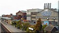
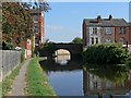

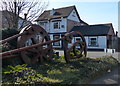
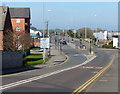
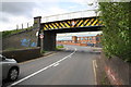
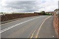
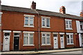
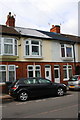

100 photos from this area
Area Information
Key information about the LE11 1LQ including its size, population, and administrative classification.
- Area Type
- Postcode
- Area Size
- 4391 m²
- Population
- 1628
- Population Density
- 2495 people/km²
House Prices in LE11 1LQ
35
Properties
£101,998
Average Sold Price
£25,500
Lowest Price
£320,000
Highest Price
Showing 35 properties
| Address | Type | Beds | Baths | Last Sale Price | Last Sale Date | |
|---|---|---|---|---|---|---|
| 26 Ratcliffe Road, Loughborough, LE11 1LQ | house | - | - | £115,000 | Dec 2023 | |
| 60 Ratcliffe Road, Loughborough, LE11 1LQ | house | - | - | £200,000 | Dec 2022 | |
| 8 Ratcliffe Road, Loughborough, LE11 1LQ | Retail | 4 | 1 | £320,000 | Sep 2022 | |
| 66 Ratcliffe Road, Loughborough, LE11 1LQ | Terraced | 3 | - | £140,000 | Sep 2021 | |
| 62 Ratcliffe Road, Loughborough, LE11 1LQ | Terraced | 2 | 1 | £144,000 | Jul 2021 | |
| 36 Ratcliffe Road, Loughborough, LE11 1LQ | Terraced | 2 | 1 | £138,000 | Jun 2020 | |
| 54 Ratcliffe Road, Loughborough, LE11 1LQ | house | - | - | £122,500 | Mar 2020 | |
| 58 Ratcliffe Road, Loughborough, LE11 1LQ | house | - | - | £120,000 | Mar 2019 | |
| 40 Ratcliffe Road, Loughborough, LE11 1LQ | Terraced | 2 | 1 | £109,000 | Mar 2018 | |
| 42 Ratcliffe Road, Loughborough, LE11 1LQ | house | - | - | £120,000 | Nov 2017 |
Page 1 of 4
Energy Efficiency in LE11 1LQ
Amenities
Schools
| Rank | School | Type | Entry gender | Ages |
|---|
Explore more schools in this area
Go to Schools tabDemographics
Household Size
Family (3-5 people)
most common
Accommodation Type
Houses
most common
Tenure
42
majority
Ethnic Group
White
most common
Religion
N/A
most common
Household Composition
N/A
most common
Age
47
median
Adults (30-64 years)
most common
Household Deprivation
N/A
with no deprivation
NS-SEC
23
in Lower managerial occupations
Explore more demographic insights in this area
Go to Demographics tabPlanning
Planning Constraints
- Flood RiskPremium
- Ramsar Wetland SitesPremium
- Area of Outstanding Natural BeautyPremium
- Protected Nature ReservePremium
- Protected WoodlandPremium