Area Overview for LE11 1JL
Photos of LE11 1JL

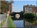
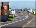
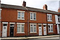
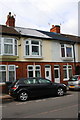

100 photos from this area
Area Information
Key information about the LE11 1JL including its size, population, and administrative classification.
- Area Type
- Postcode
- Area Size
- 6631 m²
- Population
- 1628
- Population Density
- 2495 people/km²
House Prices in LE11 1JL
52
Properties
£98,642
Average Sold Price
£3,334
Lowest Price
£177,000
Highest Price
Showing 52 properties
| Address | Type | Beds | Baths | Last Sale Price | Last Sale Date | |
|---|---|---|---|---|---|---|
| 12 Burder Street, Loughborough, LE11 1JL | Terraced | 3 | 1 | £157,500 | Aug 2025 | |
| 70 Burder Street, Loughborough, LE11 1JL | Terraced | 3 | 2 | £160,000 | Jun 2025 | |
| 68 Burder Street, Loughborough, LE11 1JL | Terraced | 3 | 1 | £156,000 | Feb 2025 | |
| 26 Burder Street, Loughborough, LE11 1JL | house | - | - | £135,000 | Sep 2024 | |
| 94 Burder Street, Loughborough, LE11 1JL | Terraced | 2 | 1 | £177,000 | Sep 2023 | |
| 16 Burder Street, Loughborough, LE11 1JL | house | - | - | £165,000 | Nov 2022 | |
| 44 Burder Street, Loughborough, LE11 1JL | Terraced | 3 | 1 | £150,000 | Oct 2022 | |
| 30 Burder Street, Loughborough, LE11 1JL | Terraced | 3 | 1 | £151,000 | Mar 2022 | |
| 20 Burder Street, Loughborough, LE11 1JL | house | 3 | - | £147,500 | Feb 2022 | |
| 8 Burder Street, Loughborough, LE11 1JL | Terraced | 2 | 1 | £151,000 | Dec 2021 |
Page 1 of 6
Energy Efficiency in LE11 1JL
Amenities
Schools
| Rank | School | Type | Entry gender | Ages |
|---|
Explore more schools in this area
Go to Schools tabDemographics
Household Size
Family (3-5 people)
most common
Accommodation Type
Houses
most common
Tenure
42
majority
Ethnic Group
White
most common
Religion
N/A
most common
Household Composition
N/A
most common
Age
47
median
Adults (30-64 years)
most common
Household Deprivation
N/A
with no deprivation
NS-SEC
23
in Lower managerial occupations
Explore more demographic insights in this area
Go to Demographics tabPlanning
Planning Constraints
- Flood RiskPremium
- Ramsar Wetland SitesPremium
- Area of Outstanding Natural BeautyPremium
- Protected Nature ReservePremium
- Protected WoodlandPremium