Area Overview for LE10 2JU
Photos of LE10 2JU
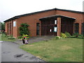
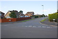
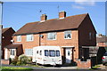
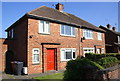
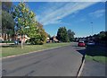
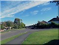
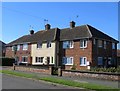
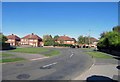
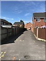
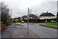
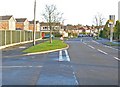
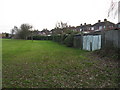
26 photos from this area
Area Information
Key information about the LE10 2JU including its size, population, and administrative classification.
- Area Type
- Postcode
- Area Size
- 1.2 hectares
- Population
- 1534
- Population Density
- 2204 people/km²
House Prices in LE10 2JU
42
Properties
£137,482
Average Sold Price
£33,500
Lowest Price
£260,000
Highest Price
Showing 42 properties
| Address | Type | Beds | Baths | Last Sale Price | Last Sale Date | |
|---|---|---|---|---|---|---|
| 37 Sycamore Close, Burbage, LE10 2JU | Terraced | 1 | 1 | £140,000 | Sep 2025 | |
| 1 Sycamore Close, Burbage, LE10 2JU | Semi-detached | 3 | 2 | £260,000 | Jun 2025 | |
| 31 Sycamore Close, Burbage, LE10 2JU | Semi-detached | 2 | 1 | £248,000 | Oct 2024 | |
| 25 Sycamore Close, Burbage, LE10 2JU | Semi-detached | 2 | 1 | £213,000 | Aug 2024 | |
| 24 Sycamore Close, Burbage, LE10 2JU | Semi-detached | 2 | 1 | £230,000 | Jun 2023 | |
| 18 Sycamore Close, Burbage, LE10 2JU | Semi-detached | 2 | 1 | £242,000 | May 2023 | |
| 27 Sycamore Close, Burbage, LE10 2JU | Semi-detached | 2 | 1 | £185,000 | Jul 2022 | |
| 36 Sycamore Close, Burbage, LE10 2JU | house | - | - | £134,000 | Jun 2022 | |
| 39 Sycamore Close, Burbage, LE10 2JU | Maisonette | 1 | 1 | £100,000 | Apr 2022 | |
| 26 Sycamore Close, Burbage, LE10 2JU | Detached | 2 | 1 | £235,000 | Nov 2021 |
Page 1 of 5
Energy Efficiency in LE10 2JU
Amenities
Schools
| Rank | School | Type | Entry gender | Ages |
|---|
Explore more schools in this area
Go to Schools tabDemographics
Household Size
Two person
most common
Accommodation Type
Houses
most common
Tenure
88
majority
Ethnic Group
White
most common
Religion
N/A
most common
Household Composition
N/A
most common
Age
47
median
Adults (30-64 years)
most common
Household Deprivation
N/A
with no deprivation
NS-SEC
45
in Lower managerial occupations
Explore more demographic insights in this area
Go to Demographics tabPlanning
Planning Constraints
- Flood RiskPremium
- Ramsar Wetland SitesPremium
- Area of Outstanding Natural BeautyPremium
- Protected Nature ReservePremium
- Protected WoodlandPremium