Area Overview for LE10 2JP
Photos of LE10 2JP
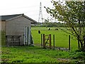
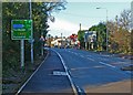
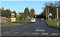
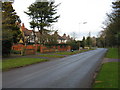
32 photos from this area
Area Information
Key information about the LE10 2JP including its size, population, and administrative classification.
- Area Type
- Postcode
- Area Size
- 3.5 hectares
- Population
- 1937
- Population Density
- 1342 people/km²
House Prices in LE10 2JP
37
Properties
£273,534
Average Sold Price
£88,000
Lowest Price
£492,500
Highest Price
Showing 37 properties
| Address | Type | Beds | Baths | Last Sale Price | Last Sale Date | |
|---|---|---|---|---|---|---|
| 20 Hawthorn Crescent, Burbage, LE10 2JP | house | - | - | £480,000 | Sep 2025 | |
| 29 Hawthorn Crescent, Burbage, LE10 2JP | Detached | 4 | 2 | £450,000 | May 2025 | |
| 9 Hawthorn Crescent, Burbage, LE10 2JP | Bungalow | - | - | £420,000 | Feb 2025 | |
| 24 Hawthorn Crescent, Burbage, LE10 2JP | house | 4 | 2 | £492,500 | Sep 2021 | |
| 1 Hawthorn Crescent, Burbage, LE10 2JP | Bungalow | 3 | 2 | £300,000 | Oct 2020 | |
| 33 Hawthorn Crescent, Burbage, LE10 2JP | Detached | 5 | 2 | £388,500 | Nov 2019 | |
| 49 Hawthorn Crescent, Burbage, LE10 2JP | Detached | 4 | 2 | £347,500 | Oct 2019 | |
| 13 Hawthorn Crescent, Burbage, LE10 2JP | Detached | 4 | 2 | £335,000 | Sep 2018 | |
| 31 Hawthorn Crescent, Burbage, LE10 2JP | Detached | 4 | - | £230,000 | Jul 2016 | |
| 11 Hawthorn Crescent, Burbage, LE10 2JP | Bungalow | 4 | 2 | £260,000 | May 2016 |
Page 1 of 4
Energy Efficiency in LE10 2JP
Amenities
Schools
| Rank | School | Type | Entry gender | Ages |
|---|
Explore more schools in this area
Go to Schools tabDemographics
Household Size
Family (3-5 people)
most common
Accommodation Type
Houses
most common
Tenure
89
majority
Ethnic Group
White
most common
Religion
N/A
most common
Household Composition
N/A
most common
Age
47
median
Adults (30-64 years)
most common
Household Deprivation
N/A
with no deprivation
NS-SEC
48
in Lower managerial occupations
Explore more demographic insights in this area
Go to Demographics tabPlanning
Planning Constraints
- Flood RiskPremium
- Ramsar Wetland SitesPremium
- Area of Outstanding Natural BeautyPremium
- Protected Nature ReservePremium
- Protected WoodlandPremium