Area Overview for LE10 2JG
Photos of LE10 2JG
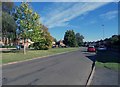
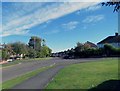
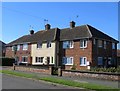
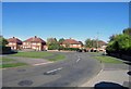
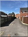
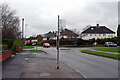
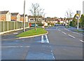
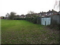
26 photos from this area
Area Information
Key information about the LE10 2JG including its size, population, and administrative classification.
- Area Type
- Postcode
- Area Size
- 1.7 hectares
- Population
- 2054
- Population Density
- 433 people/km²
House Prices in LE10 2JG
33
Properties
£215,505
Average Sold Price
£70,000
Lowest Price
£400,000
Highest Price
Showing 33 properties
| Address | Type | Beds | Baths | Last Sale Price | Last Sale Date | |
|---|---|---|---|---|---|---|
| 12 Victoria Road, Burbage, LE10 2JG | Terraced | 2 | 1 | £241,500 | Aug 2025 | |
| 4 Victoria Road, Burbage, LE10 2JG | Semi-detached | 2 | 1 | £190,000 | Jan 2025 | |
| 9 Victoria Road, Burbage, LE10 2JG | Detached | 4 | 4 | £400,000 | Mar 2021 | |
| 6 Victoria Road, Burbage, LE10 2JG | house | - | - | £220,000 | Jan 2021 | |
| 8 Victoria Road, Burbage, LE10 2JG | house | 2 | - | £218,000 | Jul 2020 | |
| 5 Victoria Road, Burbage, LE10 2JG | Detached | 2 | 1 | £387,000 | Aug 2018 | |
| Wriker, 11 Victoria Road, Burbage, LE10 2JG | house | 4 | - | £132,000 | Feb 2018 | |
| 50 Victoria Road, Burbage, LE10 2JG | Detached | 4 | 2 | £347,500 | Sep 2015 | |
| 20 Victoria Road, Burbage, LE10 2JG | Semi-detached | 5 | - | £362,000 | Jul 2015 | |
| 18 Victoria Road, Burbage, LE10 2JG | house | - | - | £154,000 | Feb 2014 |
Page 1 of 4
Energy Efficiency in LE10 2JG
Amenities
Schools
| Rank | School | Type | Entry gender | Ages |
|---|
Explore more schools in this area
Go to Schools tabDemographics
Household Size
Two person
most common
Accommodation Type
Houses
most common
Tenure
78
majority
Ethnic Group
White
most common
Religion
N/A
most common
Household Composition
N/A
most common
Age
47
median
Adults (30-64 years)
most common
Household Deprivation
N/A
with no deprivation
NS-SEC
44
in Lower managerial occupations
Explore more demographic insights in this area
Go to Demographics tabPlanning
Planning Constraints
- Flood RiskPremium
- Ramsar Wetland SitesPremium
- Area of Outstanding Natural BeautyPremium
- Protected Nature ReservePremium
- Protected WoodlandPremium