Area Overview for LE1 7DG
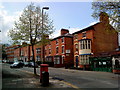
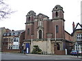
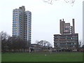
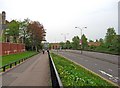
Photos of LE1 7DG


Area Information
Living in LE1 7DG means inhabiting a compact, densely populated postcode area in England, where 1,290 residents occupy just 681 square metres. This small cluster, with a population density of over 1.8 million per square kilometre, reflects a tightly knit community. The area’s character is defined by its youthful demographic: the median age is 22, with most residents aged 15–29. This suggests a dynamic, student- or young professional-oriented environment, likely shaped by nearby educational institutions or employment hubs. While the area lacks natural landscapes or protected sites, its proximity to transport networks and retail amenities makes it convenient for those prioritising connectivity over open space. However, the 16% home ownership rate indicates a rental-dominated market, with flats as the primary housing type. Daily life here is likely fast-paced, with residents relying on nearby services and public transport to navigate the area’s limited footprint.
- Area Type
- Postcode
- Area Size
- 681 m²
- Population
- 1290
- Population Density
- 11922 people/km²
The property market in LE1 7DG is characterised by a high proportion of rental properties, with only 16% of homes owned by residents. This indicates a market where private landlords and housing associations likely dominate, catering to the area’s youthful, transient population. The accommodation type is predominantly flats, reflecting the compact nature of the postcode and the need for space-efficient housing. For buyers, this presents challenges: the small area offers limited scope for property investment, and the high rental rate suggests competition for owner-occupied homes. Prospective buyers should consider the area’s density and the potential for long-term tenancy rather than immediate equity growth. The focus on flats may also mean fewer options for larger families or those seeking traditional housing. Given the small footprint of LE1 7DG, buyers should explore nearby postcode areas for more diverse property choices.
House Prices in LE1 7DG
No properties found in this postcode.
Energy Efficiency in LE1 7DG
Residents of LE1 7DG have access to a range of essential amenities within easy reach. The retail sector includes notable stores such as Tesco Lillie and Sainsburys Leicester, providing everyday shopping convenience. Three railway stations—Leicester, South Wigston, and Syston—offer frequent services to major urban centres, while three metro stations, including Leicester North and Rothley, provide additional transport options. The nearby Leicester Airport is a boon for those requiring air travel. Although the area itself is small, these amenities collectively support a functional lifestyle, enabling residents to access work, education, and leisure opportunities without needing to travel far. The presence of multiple retail outlets and transport hubs suggests a practical, service-oriented environment, though the lack of green spaces or recreational facilities may require residents to seek entertainment elsewhere.
Amenities
Schools
| Rank | School | Type | Entry gender | Ages |
|---|
Explore more schools in this area
Go to Schools tabDemographics
The community in LE1 7DG is overwhelmingly young, with a median age of 22 and the majority of residents aged 15–29. This suggests a population skewed towards students, recent graduates, or young professionals, possibly linked to nearby educational or employment opportunities. Home ownership is minimal, with only 16% of residents owning their homes, meaning 84% live in rented accommodation. The predominant housing type is flats, reflecting a high-density living arrangement. The area’s demographic is predominantly White, with no specific data on other ethnic groups provided. While the data does not include deprivation metrics, the high proportion of young renters implies a transient population, which may influence local services and social dynamics. The absence of protected natural areas or heritage sites also suggests a focus on urban living, with amenities and transport links likely serving as the primary draw for residents.
Household Size
Accommodation Type
Tenure
Ethnic Group
Religion
Household Composition
Age
Household Deprivation
NS-SEC
Explore more demographic insights in this area
Go to Demographics tabPlanning
Planning Constraints
- Flood RiskPremium
- Ramsar Wetland SitesPremium
- Area of Outstanding Natural BeautyPremium
- Protected Nature ReservePremium
- Protected WoodlandPremium