Area Overview for DN22 9NQ
Photos of DN22 9NQ
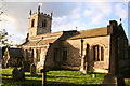
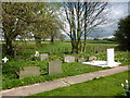
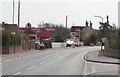
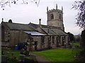
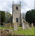
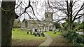
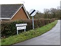
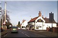
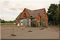
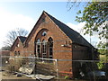
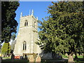
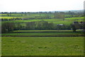
32 photos from this area
Area Information
Key information about the DN22 9NQ including its size, population, and administrative classification.
- Area Type
- Postcode
- Area Size
- 10.5 hectares
- Population
- 1824
- Population Density
- 55 people/km²
House Prices in DN22 9NQ
25
Properties
£265,447
Average Sold Price
£68,000
Lowest Price
£525,000
Highest Price
Showing 25 properties
| Address | Type | Beds | Baths | Last Sale Price | Last Sale Date | |
|---|---|---|---|---|---|---|
| Eslaforde, Church Lane, Clarborough, DN22 9NQ | Bungalow | 3 | 1 | £260,000 | Dec 2024 | |
| 10 Church Lane, Clarborough, DN22 9NQ | Bungalow | 3 | 2 | £395,000 | Nov 2024 | |
| Nepani House, Church Lane, Clarborough, DN22 9NQ | Detached | 3 | 3 | £525,000 | Oct 2024 | |
| Edelweiss, Church Lane, Clarborough, DN22 9NQ | Bungalow | 3 | 2 | £375,000 | Aug 2023 | |
| Hillsboro, Church Lane, Clarborough, DN22 9NQ | Bungalow | 2 | 1 | £270,000 | Sep 2022 | |
| 9 Church Lane, Clarborough, DN22 9NQ | Detached | - | - | £150,000 | Apr 2022 | |
| Belvedere, 4 Church Lane, Clarborough, DN22 9NQ | Bungalow | - | - | £450,000 | Oct 2021 | |
| Dane Bank, Church Lane, Clarborough, DN22 9NQ | Bungalow | 5 | - | £375,000 | Sep 2021 | |
| 2 Church Lane, Clarborough, DN22 9NQ | Bungalow | 3 | 1 | £255,000 | Jun 2021 | |
| Lealholm, 7 Church Lane, Clarborough, DN22 9NQ | Bungalow | 3 | - | £272,500 | Sep 2020 |
Page 1 of 3
Energy Efficiency in DN22 9NQ
Amenities
Schools
| Rank | School | Type | Entry gender | Ages |
|---|
Explore more schools in this area
Go to Schools tabDemographics
Household Size
Two person
most common
Accommodation Type
Houses
most common
Tenure
83
majority
Ethnic Group
White
most common
Religion
N/A
most common
Household Composition
N/A
most common
Age
47
median
Adults (30-64 years)
most common
Household Deprivation
N/A
with no deprivation
NS-SEC
39
in Lower managerial occupations
Explore more demographic insights in this area
Go to Demographics tabPlanning
Planning Constraints
- Flood RiskPremium
- Ramsar Wetland SitesPremium
- Area of Outstanding Natural BeautyPremium
- Protected Nature ReservePremium
- Protected WoodlandPremium