Area Overview for Breaston and Draycott
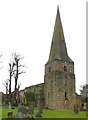
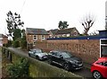
Photos of Breaston and Draycott


Area Information
Breaston and Draycott is a compact built-up area in England, covering 2.0 km². It is a small, mature community with a median age of 70, suggesting a population skewed toward older residents. The area blends practicality with accessibility, offering a mix of local amenities and transport links. Daily life here is shaped by proximity to schools, retail hubs, and public transport, making it suitable for those prioritising convenience over urban vibrancy. The presence of multiple primary and special schools, including Firfield Primary School and Spring Valley School, ensures families have options for education. While the area lacks large-scale commercial or cultural attractions, its compact size means essential services are within walking or short driving distance. For those seeking a quiet, low-maintenance lifestyle with reliable infrastructure, Breaston and Draycott provides a straightforward, no-frills environment. Its rail and tram connections to nearby towns like Long Eaton and Derby also offer flexibility for commuters or those needing access to larger cities.
- Area Type
- Built Up Area 250
- Area Size
- 2.0 km²
- Population
- Not available
- Population Density
- Not available
Breaston and Draycott offers a range of practical amenities within easy reach. Retail options include Co-op Breaston, Spar Harvest, and Tesco Long, providing everyday shopping needs. The area’s transport links, including rail stations like Long Eaton and Spondon, make commuting to larger cities feasible. For leisure, the nearby East Midlands Airport offers travel opportunities, though local parks or recreational spaces are not specified in the data. The presence of multiple schools and public transport options suggests a focus on functionality over luxury. While the area lacks large-scale entertainment venues, its proximity to Derby and Nottingham via rail means residents can access cultural and commercial hubs without long commutes. The combination of retail, transport, and educational facilities supports a straightforward, convenience-driven lifestyle.
Amenities
Schools
The area is served by several schools, including Firfield Primary School, which holds a ‘good’ Ofsted rating, and Draycott Community Primary School, which is listed but lacks a rating. Special schools such as Spring Valley School and Ellern Mede Derby School also provide education for students with specific needs, both rated ‘good’ by Ofsted. This mix of primary and special schools ensures families have options for both mainstream and specialist education. The presence of multiple primary schools, including a second listing for Draycott Community Primary School, suggests a focus on local, community-based education. While the data does not indicate school catchment areas or pupil numbers, the availability of both general and specialist provision could be a key consideration for families with diverse educational needs.
| Rank | School | Type | Entry gender | Ages |
|---|
Explore more schools in this area
Go to Schools tabDemographics
The population of Breaston and Draycott has a median age of 70, reflecting a community dominated by older adults. This age profile suggests a demographic with established routines and limited demand for amenities targeting younger families or students. Home ownership is high, with 76% of households owning their homes, indicating a stable, long-term resident base. The data does not specify household composition or accommodation types, but the overall home ownership rate implies a lower proportion of rental properties compared to areas with younger, more transient populations. The lack of detailed information on ethnic groups, religions, or deprivation levels means broader social diversity and economic challenges cannot be assessed. However, the high home ownership and mature age profile suggest a community with low turnover and a focus on maintaining property values rather than rapid development.