Area Overview for Borrowash
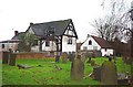
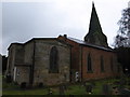
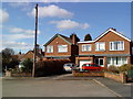
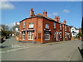
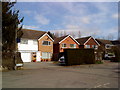
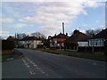
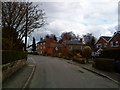
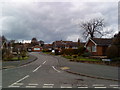
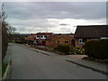
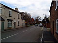
Photos of Borrowash


Area Information
Borrowash stands as a built-up area within Derbyshire, covering 2.1 km². This compact footprint creates a dense concentration of homes and local life. The character of the neighbourhood is defined by its established nature, distinguishing it from newer suburban expansions. Residents here navigate a specific rhythm that blends residential comfort with accessible town connectivity. The area functions well as a home base for those working in nearby urban centres like Derby or Nottingham. Its small physical size means amenities and key routes are often within a short walking distance for many households. You will find that daily trips involve moving across a defined territory where streets meet convenience. The district does not boast a sprawling geography, which can make navigating the local environment straightforward for new arrivals. Living in Borrowash presents a scenario where proximity to services is a primary advantage. The built environment supports a community-focused existence rather than a car-dependent lifestyle, although transport links ensure wider access remains possible. You enter a space where the layout has been settled for a considerable time, offering a sense of stability. This established status means the infrastructure you encounter is proven, avoiding the developmental uncertainty found in growing sectors. The area accommodates those seeking a town centre feel without the scale of a major city.
- Area Type
- Built Up Area 250
- Area Size
- 2.1 km²
- Population
- Not available
- Population Density
- Not available
Daily life in Borrowash benefits from a variety of amenities within practical reach of residents. Retail options include a Co-op in Borrowash and the Co-op in Spondon, alongside the large Asda supermarket in Derby. These venues provide everything from daily groceries to extended shopping lists without requiring a drive to distant town centres. For rail travel, five stations are readily accessible, including Spondon Railway Station and the main Derby Railway Station. Long Eaton Railway Station is also within your reach, offering multiple train connections across the Midlands. Public transport users will appreciate the proximity of the Tram Park and Ride and Toton Lane Tram Stop. The Inham Road tram stop provides targeted access to the city tram network. Two airports are listed as nearby options, both identified as East Midlands Airport, offering significant flight connectivity. Residents have direct access to both national rail and air travel hubs. This network allows you to commute to Manchester, Birmingham, or London with ease. The combination of local shops, rail interchanges, and airport access creates a lifestyle that balances local convenience with regional mobility.
Amenities
Schools
Families accessing education often look at several institutions within practical reach of Borrowash. You will find two primary options directly linked to the local infrastructure: Ashbrook Infant School and Ashbrook Junior School. These two establishments combine to form the main state provision for younger children in the vicinity. Another state primary option is Redhill Primary School, which holds an outstanding Ofsted rating. This top rating signals a high standard of education, making it a magnet for parents seeking quality instruction. For those preferring independent education, Ockbrook School is located nearby. The presence of both state and independent options provides flexible choices for households in Borrowash. The mix of schools indicates that the area serves multiple generations, despite the older average age of residents. You might find semi-detached schools like the infant and junior sections serving a steady stream of local children. The outstanding rating of Redhill Primary School adds significant weight to the educational reputation of the area. When considering schools near Borrowash, the blend of state and private institutions ensures that families have varied pathways available to them.
| Rank | School | Type | Entry gender | Ages |
|---|
Explore more schools in this area
Go to Schools tabDemographics
The community in Borrowash has a distinct demographic profile characterised by a mature population. The median age sits at 70, indicating that residents in this area are significantly older than the national average. Age data shows the total population skewed heavily towards senior citizens, suggesting a neighbourhood where many homes are occupied by retirees or older couples. You will find that the traditional family home structure is less common than the empty nester or single-person household. Consequently, the social fabric likely revolves around community groups, local clubs, or neighbours looking out for one another. A strong 75% homeownership rate defines the social structure of Borrowash. This high figure implies that the majority of residents have long-term security in their properties rather than navigating the uncertainties of the rental market. When considering accommodation types, the dominance of owners suggests a stock likely comprised of mid-to-late century homes suitable for older residents. The area is stable, with few transient populations moving through quickly. This environment suits those who value quiet and permanence over rapid social turnover. Living in Borrowash means engaging with a settled group of people who share a long-term commitment to their homes.